| FAMSI © 2005: William M. Ringle |
||
The 2001 Field Season of the Labná-Kiuic Archaeological Project
Research Year: 2001 Table of Contents
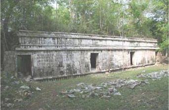
Introduction It has been obvious since the pioneering expeditions of John Lloyd Stephens in 1839-41 and again in 1842 (Stephens 1969, 1962), and those of Teobert Maler between 1886-1893 (Maler 1895, 1997), that the architecture of the Puuc region constitutes a distinct subdivision of ancient Maya artistic expression. Later reconnaissance, particularly by the Carnegie Institution during the 1930s and '40s (Pollock 1980) and the Atlas Arqueológica de Yucatán (Garza T. and Kurjack 1980) during the 1970s and '80s, demonstrated that this regional character is also reflected in its settlement patterns, perhaps not surprisingly given the distinctive terrain of the region. One of the most noticeable differences is the absence of large Rank 1 and 2 sites and conversely, the dense packing of smaller Rank 3 sites, of which Labná and Kiuic are fairly typical representatives. This is in reality an oversimplification of both the landscape and the settlement patterns of the Puuc (Figure 1). The edge of the Puuc is delimited by a fault line, behind which rises the narrow escarpment called the Sierrita de Ticul (Duch Gary 1988). At the eastern extreme of the Puuc is the Valle de Santa Elena, a wedge-shaped area of generally low relief and deep soils. Today this is a region of high agricultural productivity, and it is thus not surprising that the largest sites of the Puuc – Uxmal, Nohpat, Kabáh, etc. – fall within or along the borders of this feature. As in the northern plains, these large sites seem to have dictated a fairly dispersed distribution of smaller sites. In contrast, in the Bolonchén District to the east and south, cone karst hills predominate and Rank 3 site density is high (Figure 2). Between these hills are "flats" of relatively deep soils (Figure 3), but of limited extension, no doubt accounting in part for the scarcity of larger sites. Dunning (1992) has demonstrated how soil formation in this region is a direct result of topography, ranging from the thin tzekel soils on the upper slopes of cone karst hills to deeper clayey kancabal soils in the flats. In areas of intermediate slope, a variety of soils may develop, often within close proximity to one another. This combination of microenvironments, coupled with larger expanses of kancabal soils, offered a variety of opportunities for ancient agriculturalists, leading some modern commentators to characterize the Puuc as the "breadbasket of Yucatán" (e.g., Barrera R. 1979). Yet was this true for the Bolonchén District? GIS modeling of the terrain using digital elevation data from I.N.E.G.I. casts some doubt on this reconstruction. If land is classified by slope as a proxy for soil types, and if Thiessen polygons are used as a first approximation of the territory of Rank 2 and 3 sites, it can be seen that the acreage of prime flats varies considerably (Figure 4, Figure 5, Figure 6, and Figure 7, Gallareta N. and Ringle 2002), yet in no case would seem to provide a significant surplus above that necessary for the estimated populations of Dunning (1992). Despite this, these sites show an elevated level of prosperity as reflected by investment in vaulted architecture. We must at least therefore entertain the idea that some of this wealth derived from resources other than the export of foodstuffs. During the 1980s, research centered around Sayil (Sabloff and Tourtellot 1991), in conjunction with the related trail survey of Nicholas Dunning (1992), considerably advanced our understanding of Bolonchén archaeology. This was the first extensive settlement study of any site in the Bolonchén District, eventually covering an estimated 55% of the entire site. Dunning's work provided a regional context within which to situate Sayil. In addition to the soil studies mentioned above, he briefly visited over 100 sites, recording the location and setting of each and range of architectural features. Since the work at Sayil, projects have been initiated at nearby Chac (e.g., Smyth et al. 1998, 2003), and Labná (Gallareta 2003), as well as a number of other INAH salvage and consolidation projects. 1 Mention should also be made of earlier work at Xkukican (DeJarnette et al. 1966) which was, however, only published in report form, and the extensive architectural survey made by George F. Andrews (1986, 1995), which provided a valuable supplement to Pollock's earlier work.
Click to download the report in PDF format: The 2001 Field Season of the Labná-Kiuic Archaeological Project (5.59 MB) The PDF files require Adobe Acrobat Reader.
Submitted 08/17/2001 by: |
||
| Return to top of page | ||
|
Text links to all pages at this site are available at the FAMSI INDEX |
||