| FAMSI © 2003: Paul Schmidt |
||
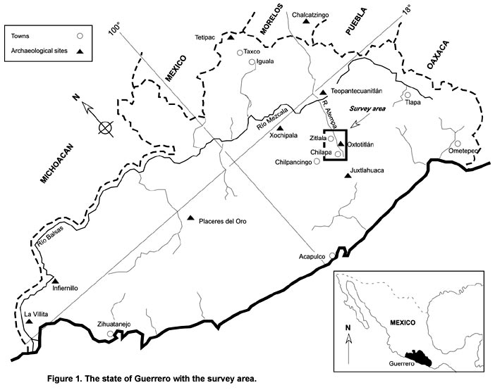
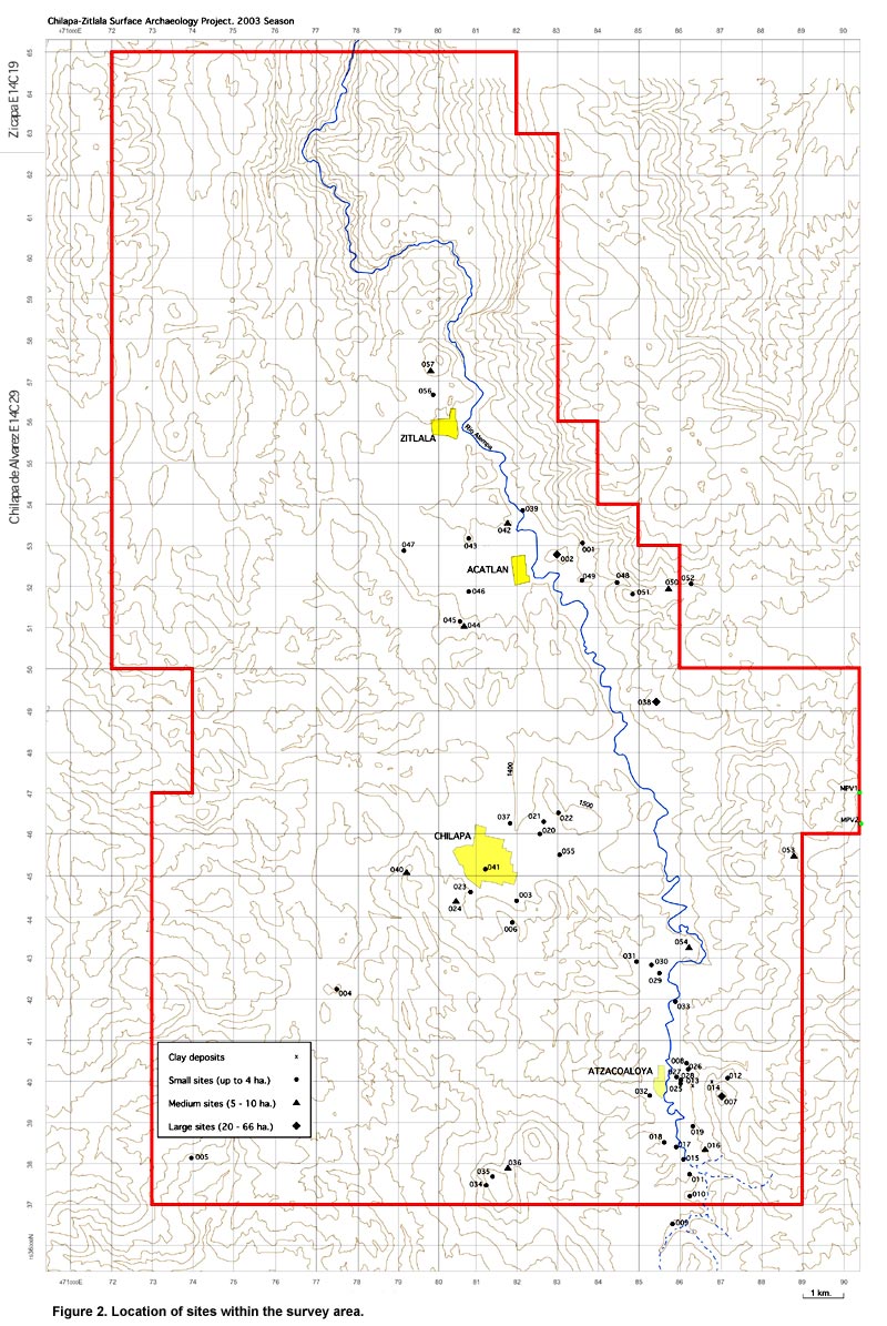
Surface Archaeology in the Chilapa-Zitlala Area of Guerrero, México, Season I Introduction The idea of this project is to carry out an archaeological survey of approximately 386 km2 over three field seasons (2003-2005) in the lower mountain area of Central Guerrero, along the Atempa River drainage (Figure 1, Figure 2). The main purpose is to characterize the area through its archaeological materials, establish a chronology, and analyze the settlement pattern. Compared to other parts of Guerrero, such as the Central and North subareas (Paradis and La Farge (eds.) 1999; Schmidt 1976, 1990; Schmidt and Litvak 2001), this area, east of the México City-Acapulco highway, is practically unknown except for David Grove’s (1970a, 1970b) report of the Olmec paintings at Oxtotitlán (Figure 3, shown below), located in the middle of my proposed area, and one site–Tlaltizate–reported by Antonio Porcayo (personal communication) in a salvage project survey by INAH between Chilpancingo and Chilapa in 2001. North of the area is Teopantecuanitlán (Martínez Donjuan 1982, 1986, 1994; Niederberger 1986; Reyna 1996), and to the south is Juxtlahuaca (Gay 1967; Griffin 1982; Grove 1967). The nearest sequences are from Chilpancingo (Schmidt 1976) and Xochipala (Schmidt 1990) to the west, while to the north Chalcatzingo (Grove 1987) is the most relevant. Although some archaeological work has been done in the mountains to the east, in the area of Tlapa and Huamuxtitlán, there are still no sequences nor descriptions of materials.
Another major objective, mainly of a culture-historical nature, is to contextualize the Oxtotitlán paintings and explain the Olmec presence, whether there was a more or less permanent presence of Gulf Coast peoples during the Early and/or Middle Formative periods which would be reflected in Olmec-style artifacts at nearby sites, or if the contact was of a more spurious nature. Lying half way between Teopantecuanitlán to the north (27 km) and Juxtlahuaca to the south (24 km), it would appear to be part of a major Olmec corridor extending from eastern Morelos to central eastern Guerrero. An attempt will also be made to define the Yope border in the Chilapa area, perhaps locating the Aztec garrison established on the frontier with Yopitzingo (Ortega 1940) in 1458 during Moctezuma Ihuilcamina’s reign (Harvey 1967: 3). This is also an area of dry caves, and the possibility of early domestic corn in the Balsas drainage (MacNeish and Eubanks 2000; Matsuoka et al. 2002) should be kept in mind. |
||
|
Text links to all pages at this site are available at the FAMSI INDEX |
||
.")