| |
Surface Archaeology in the Chilapa-Zitlala Area of Guerrero, México, Season I
List of Figures
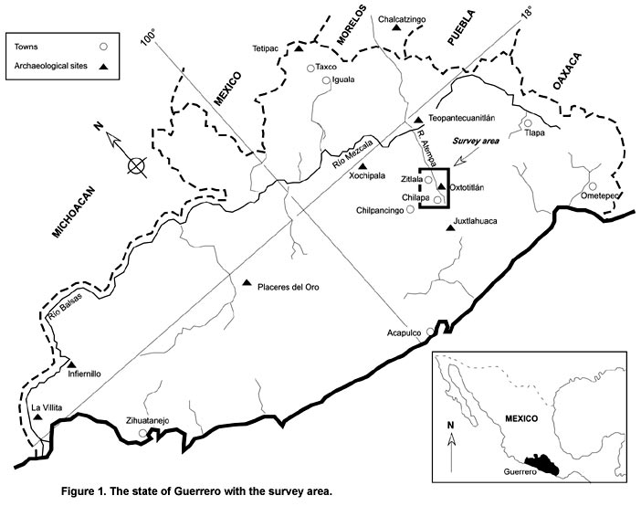
Figure 1. The state of Guerrero with the survey area.
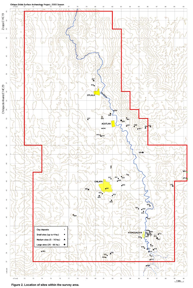
Figure 2. Location of sites within the survey area.
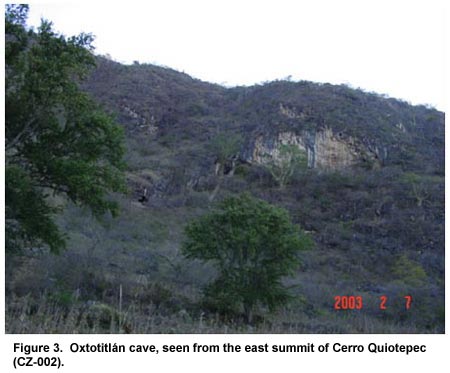
Figure 3. Oxtotitlán cave, seen from the east summit of Cerro Quiotepec (CZ-002).
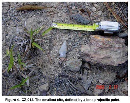
Figure 4. CZ-012. The smallest site, defined by a lone projectile point.
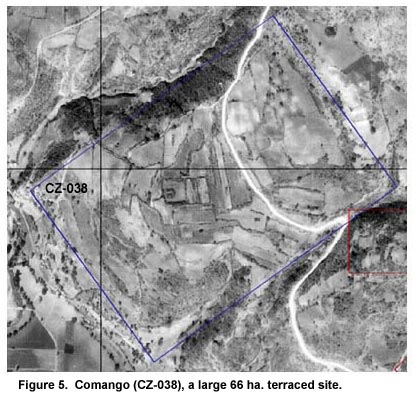
Figure 5. Comango (CZ-038), a large 66 ha. terraced site.
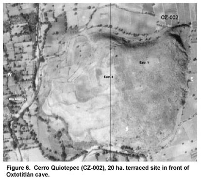
Figure 6. Cerro Quiotepec (CZ-002), 20 ha. terraced site in front of Oxtotitlán cave.
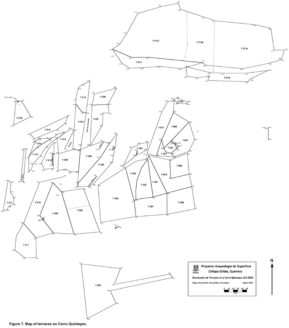
Figure 7. Map of terraces on Cerro Quiotepec.
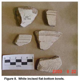
Figure 8. White incised flat-bottom bowls.
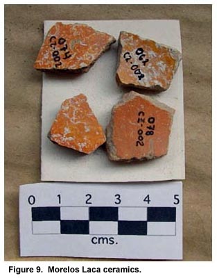
Figure 9. Morelos Laca ceramics.
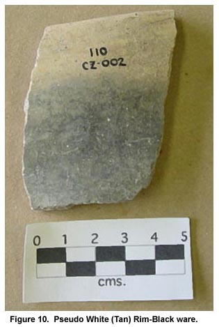
Figure 10. Pseudo White (Tan) Rim-Black ware.
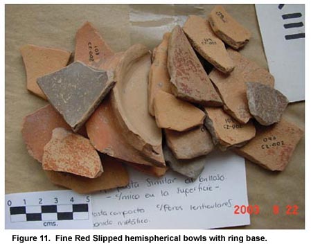
Figure 11. Fine Red Slipped hemispherical bowls with ring base.
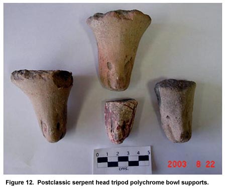
Figure 12. Postclassic serpent head tripod polychrome bowl supports.
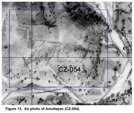
Figure 13. Air photo of Amoltepec (CZ-054).
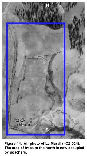
Figure 14. Air photo of La Muralla (CZ-024). The area of trees to the north is now occupied by poachers.
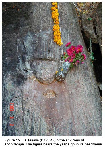
Figure 15. La Tesaya (CZ-034), in the environs of Xochitempa. The figure bears the year sign in its headdress.
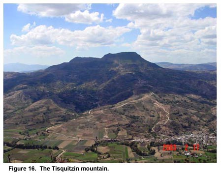
Figure 16. The Tisquitzín mountain.
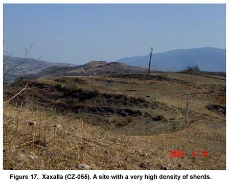
Figure 17. Xaxalla (CZ-055). A site with a very high density of sherds.
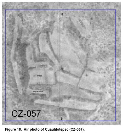
Figure 18. Air photo of Cuauhlotepec (CZ-057).
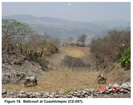
Figure 19. Ballcourt at Cuauhlotepec (CZ-057).
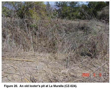
Figure 20. An old looter’s pit at La Muralla (CZ-024).
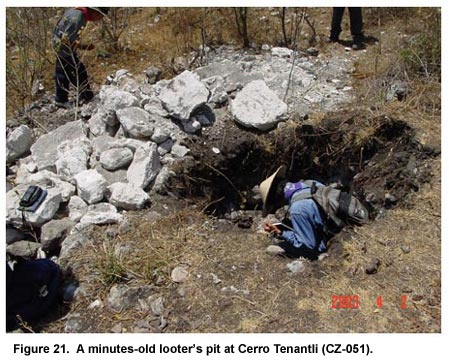
Figure 21. A minutes-old looter’s pit at Cerro Tenantli (CZ-051).
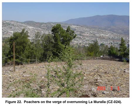
Figure 22. Poachers on the verge of overrunning La Muralla (CZ-024).
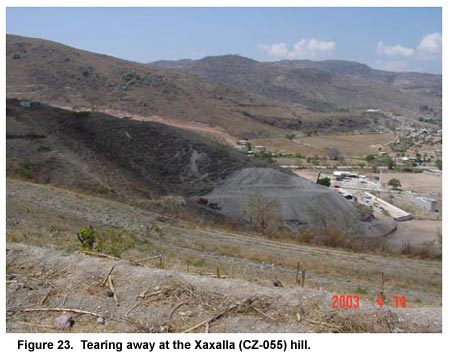
Figure 23. Tearing away at the Xaxalla (CZ-055) hill.
Figure 24. The survey team. From left to right: Paul Schmidt, Gabriel Lima, Iliana Miguel, and Eliseo Padilla.
Previous Page | Table of Contents | Next Page |