| FAMSI © 2003: Charles Golden |
||
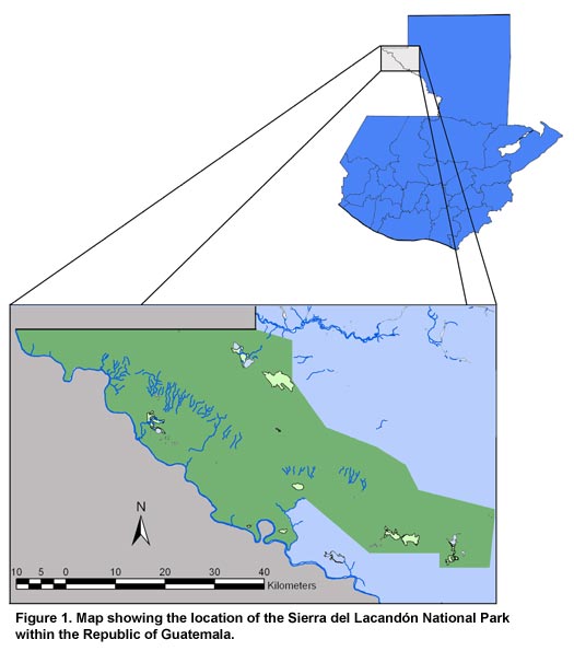
Sierra del Lacandón Regional Archaeology Project Introduction This report describes the results of the first field season of the Sierra del Lacandón Regional Archaeology Project (SLRAP). Supported by a grant from the Foundation for the Advancement of Mesoamerican Studies, Inc., (FAMSI), a team of Guatemalan and American archaeologists, soils scientists, and park guards working with the assistance of workers from Dolores, Petén carried out the first systematic archaeological reconnaissance of the Sierra del Lacandón National Park of Guatemala from May 10 to June 1, 2003. The SLRAP was conducted as a subproject of the Piedras Negras Regional Archaeological Project, an integral part of the Fundacíon Defensores de la Naturaleza’s work towards the protection of cultural patrimony in the Sierra del Lacandón National Park of Guatemala (Figure 1). 1
The primary research goal of the SLRAP is to achieve a better understanding of political integration in Classic period Maya society, particularly as this pertains to the relationship between primary rulers and the subordinate nobility who governed the frontier settlements between competing kingdoms. In addition, the SLRAP was charged by park authorities with creating a cultural inventory of the park in low-lying areas adjacent to the Usumacinta River that are threatened by inundation resulting from the construction of hydroelectric dams at the Boca del Cerro in Tabasco, México (Figure 2, shown above). 2 In this brief first field season, the SLRAP achieved great success in establishing the basis for future research in the park. Members of the project identified two previously unknown sites and investigated two sites that had been informally reported, but not adequately documented (Figure 3, shown below).
|
||
|
Text links to all pages at this site are available at the FAMSI INDEX |
||
.")
