| |
Sierra del Lacandón Regional Archaeology Project
List of Figures
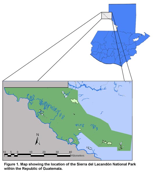
Figure 1. Map showing the location of the Sierra del Lacandón National Park within the Republic of Guatemala.
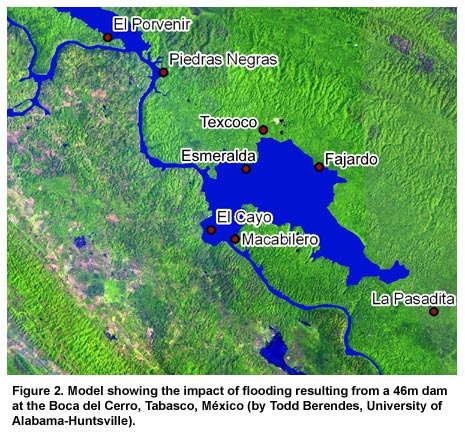
Figure 2. Model showing the impact of flooding resulting from a 46 m dam at the Boca del Cerro, Tabasco, México (by Todd Berendes, University of Alabama-Huntsville).
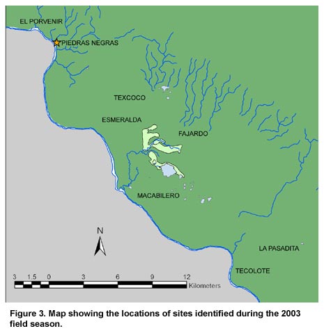
Figure 3. Map showing the locations of sites identified during the 2003 field season.
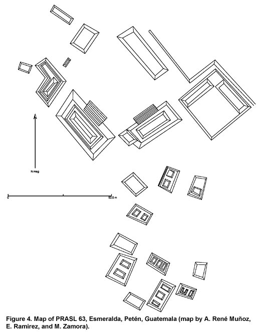
Figure 4. Map of PRASL 63, Esmeralda, Petén, Guatemala (map by A. René Muñoz, E. Ramirez, and M. Zamora).
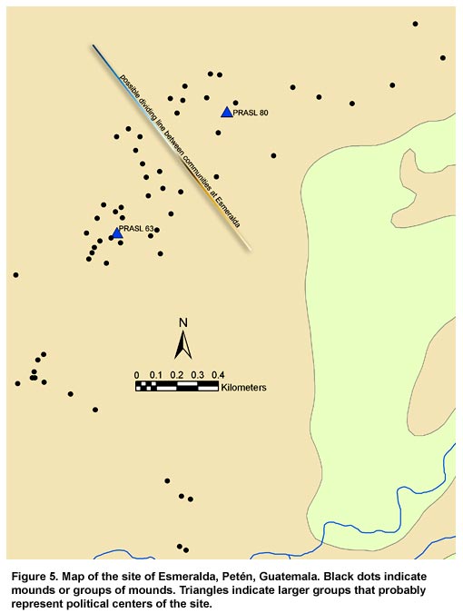
Figure 5. Map of the site of Esmeralda, Petén, Guatemala. Black dots indicate mounds or groups of mounds. Triangles indicate larger groups that probably represent political centers at the site.
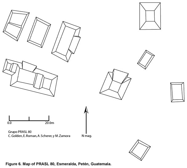
Figure 6. Map of PRASL 80, Esmeralda, Petén, Guatemala.
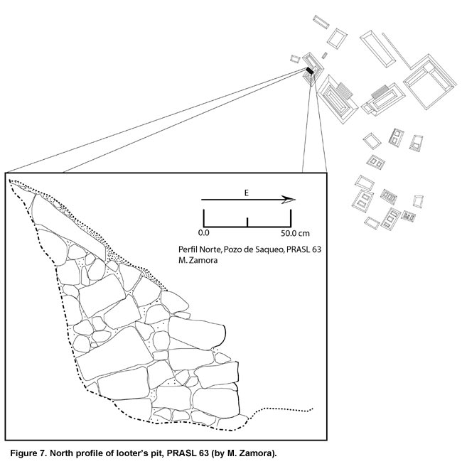
Figure 7. North profile of looter’s pit, PRASL 63 (by M. Zamora).
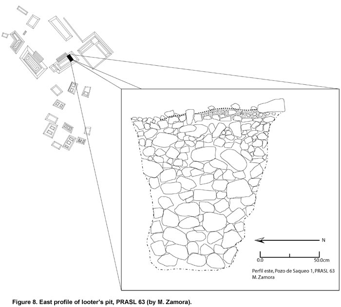
Figure 8. East profile of looter’s pit, PRASL 63 (by M. Zamora).
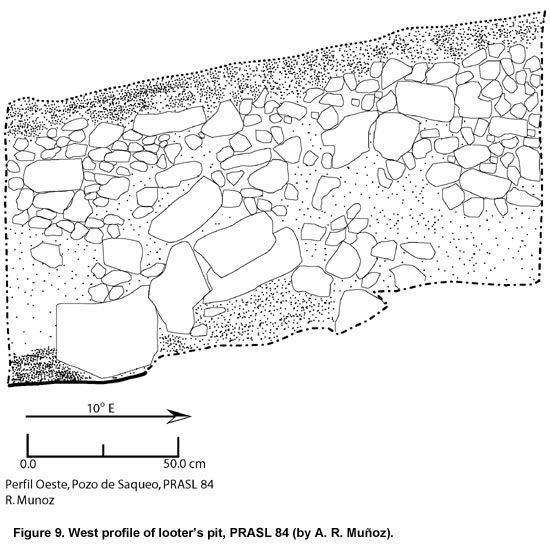
Figure 9. West profile of looter’s pit, PRASL 84 (by A.R. Muñoz).
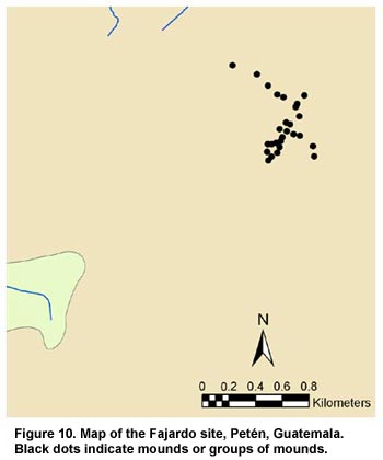
Figure 10. Map of the Fajardo site, Petén, Guatemala. Black dots indicate mounds or groups of mounds.
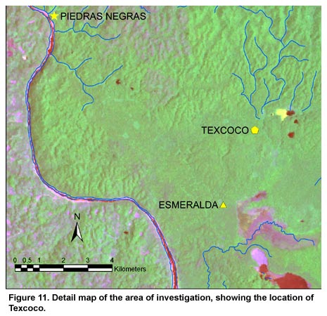
Figure 11. Detail map of the area of investigation, showing the location of Texcoco.
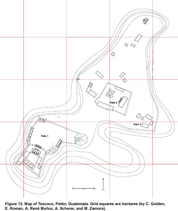
Figure 12. Map of Texcoco, Petén, Guatemala. Grid squares are hectares (by C. Golden, E. Roman, A. René Muñoz, A. Scherer, and M. Zamora).
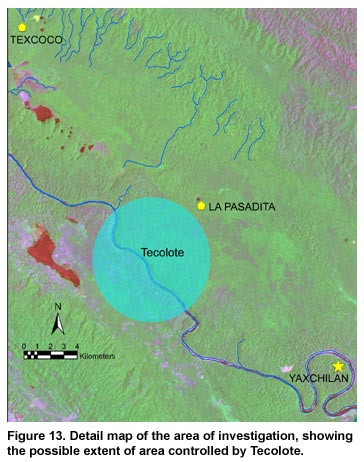
Figure 13. Detail map of the area of investigation, showing the possible extent of area controlled by Tecolote.
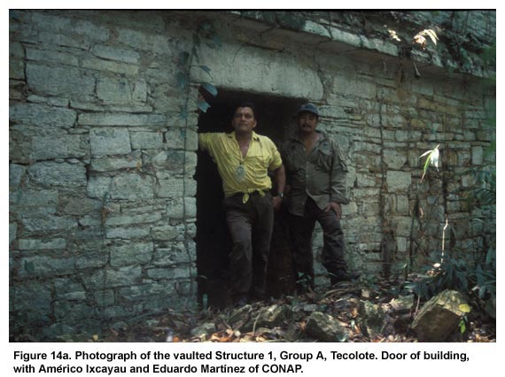
Figure 14a. Photograph of the vaulted Structure 1, Group A, Tecolote. Door of building, with Américo Ixcayau and Eduardo Martínez of CONAP.
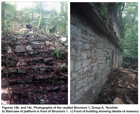
Figure 14bc. Photographs of the vaulted Structure 1, Group A, Tecolote. (b) Staircase of platform in front of Structure 1. (c) Front of building showing details of masonry.
Figure 15. Map of Group A, Tecolote, Petén, Guatemala (by A.R. Muñoz and A. Scherer).
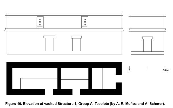
Figure 16. Elevation of vaulted Structure 1, Group A, Tecolote (by A.R. Muñoz and A. Scherer).
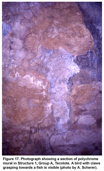
Figure 17. Photograph showing a section of polychrome mural in Structure 1, Group A, Tecolote. A bird with claws grasping towards a fish is visible (photo by A. Scherer).
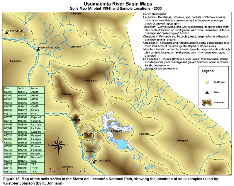
Figure 18. Map of the soils series in the Sierra del Lacandón National Park, showing the locations of soils samples taken by Kristofer Johnson (by K. Johnson).
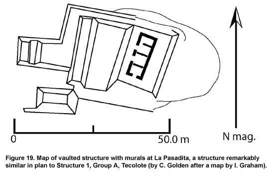
Figure 19. Map of vaulted structure with murals at La Pasadita, a structure remarkably similar in plan to Structure 1, Group A, Tecolote (by C. Golden after a map by I. Graham).
Previous Page | Table of Contents | Next Page
Return to top of page |