| |
Tepeaca Kiln Project
List of Figures
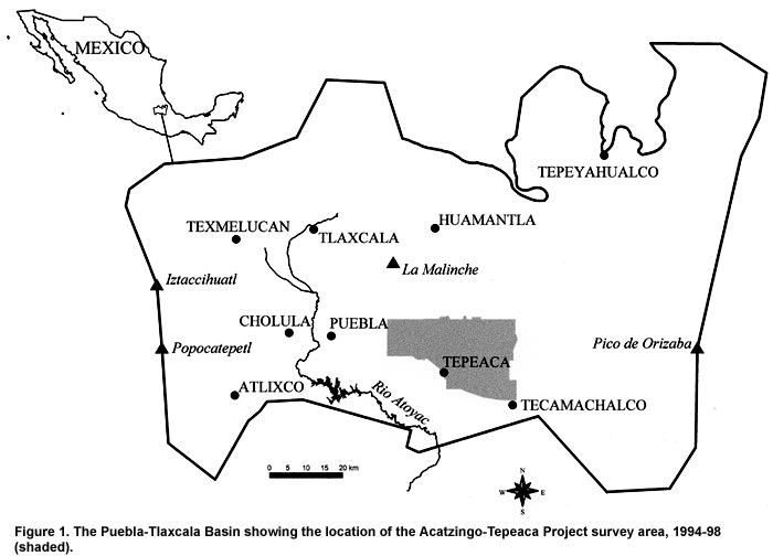
Figure 1. The Puebla-Tlaxcala Basin showing the location of the Acatzingo-Tepeaca Project survey area, 1994-98 (shaded).
Figure 2. The Acatzingo-Tepeaca Project survey area with the Tepeaca Kiln Project coverage in 2003.
Figure 3. The Tepeaca Kiln Project in 2003 showing the locations of kilns and excavation units. The identification numbers of kilns with dated pottery are shown.
Figure 4. Excavation 621-A, east profile.
Figure 5. Photograph of the excavation 623 (Suboperations A-1 and A-2).
Figure 6. Excavation 623-A-1, north profile.
Figure 7. Excavation 623-A-2, south profile.
Figure 8. Excavation 623-A-2, plan (kiln floor).
Figure 9. Kiln K50 (facing east) as it appeared prior to excavation.
Figure 10. Excavation 623-B, north profile.
Figure 11. Excavation 623-B, plan.
Figure 12. Excavation 623-C, east profile.
Figure 13. Kiln K51 (facing west) as it appeared prior to excavation.
Figure 14. Excavation 623-D, plan.
Figure 15. Excavation 623-D, south profile.
Figure 16. Remains of an oval pit kiln at the Formative Period site at which excavations are planned in 2004.
Figure 17. Formative Period ceramic kiln site facing east; a very dense concentration of sherds can be seen in the foreground as well as a small pothunter’s pit in the upper left at the edge of the earth island.
Previous Page | Table of Contents | Next Page |