| FAMSI © 2004: Marcello A. Canuto and Ellen E. Bell |
||||||||||||||||||||||||||||||||||||||||||||||||||||||||||||||||||||||||||||||||||||||||||||||||||||||||||||||||||||||||||||||||||||
|
Classic Maya Borders and Frontiers: Excavations at El Paraíso, Copán, Honduras, 2003 Season
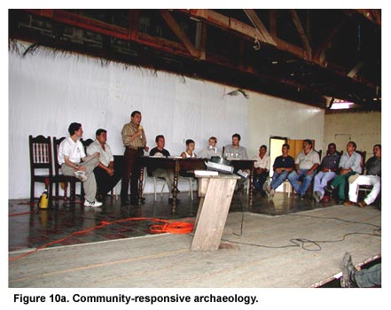
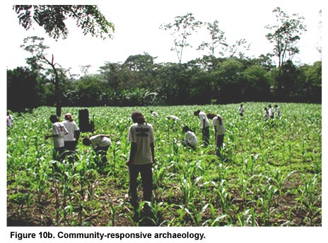
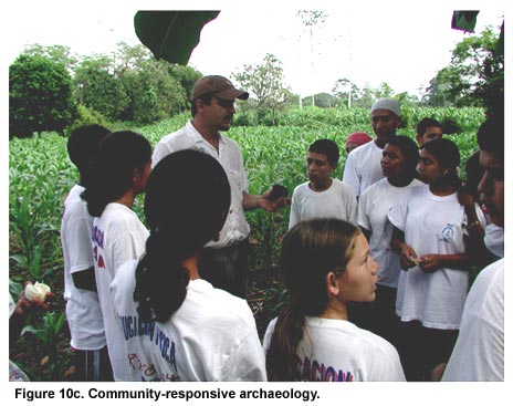
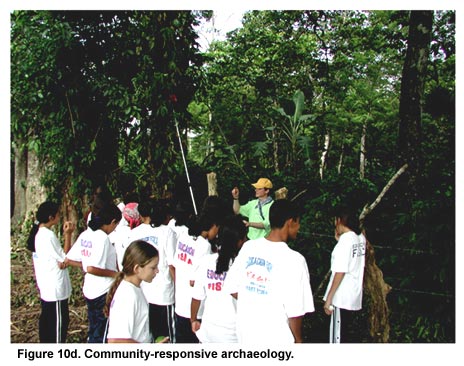
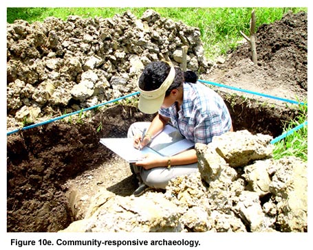
Research 2003 There were three primary objectives to PAREP’s 2003 field season: scientific, pedagogical, and socio-economic. Although the latter two objectives are critical to the social and ethical well-being and good-standing of the project within the small community of El Paraíso, this report will focus on the results of the scientific objectives of the 2003 field season. It is important to note, however, that PAREP’s "extra-archaeology" objectives relate to the development of a socially-responsive (or ethical, community, post-colonial) form of archaeological research that recognizes the responsibilities archaeologists shoulder by developing long-term research projects in small communities like El Paraíso (Figures 10a through 10e). There is growing appreciation among Maya archaeologists for the impact their research practices make within the local context. Although this impact, its ramifications, and our responses lie beyond the scope of this research report, it remains a critical aspect of our research presence in El Paraíso.
With regards to the archaeological research conducted during PAREP’s second major field season (2003), emphasis was placed on the development of several different lines of investigation. Namely, the 2003 season focused on (1.) regional reconnaissance of the region outside the El Paraíso valley, (2.) settlement survey of the entire El Paraíso valley (ca. 25 sq. km), (3.) the topographic mapping of the several sectors of the valley (ca. 4 sq. km), and finally (4.) test excavations at the primary centers of the El Paraíso valley. These different research initiatives led to a multi-scalar approach aimed at addressing the complex problems discussed above.
What follows is a brief discussion of the major results of the 2003 season with regards to these different lines of research. A discussion follows these descriptions addressing how the research of this and past seasons will help further development of the scientific goals of PAREP.
Given the importance of the interchange within the southeastern Maya area during the Classic period (A.D. 200-900), the regional reconnaissance was designed to study the regions outside of the El Paraíso valley, specifically those intermontane river valleys that would allow for communication, passage, and exchange among the El Paraíso, Copán, Río Amarillo, Chamelecón, and Motagua river valleys. This broad goal was categorized into several tasks for the 2003 season:
(1) Familiarization with geology/topography of the El Paraíso valley environs. The first step in our reconnaissance consisted of identifying those areas likely used for passage based on USGS topographic maps of the region. In this endeavor, it was critical to identify not only the points of egress from the valley, but also their destination points. Four major areas/sites were identified as potential destination points for travelers outbound from the El Paraíso valley: Quiriguá to the north, Río Amarillo to the south, Copán to the south-west, and El Puente to the east. Passable routes to these centers were defined by their combination of several topographically relevant and pragmatic factors such as total travel distance, relative flatness, directness between points, and relative propinquity to permanent water. In the future, a more rigorous model that includes not only a wider range of factors (such as field-of-vision, proximity to resources), but also procedures for the quantification of all these factors will be adopted. For the 2003 season, however, only a handful of factors were defined and compared qualitatively. The second step consisted of walking the various routes to record both topographic features and the presence of any ancient settlement. Through this procedure, PAREP personnel recognized the possible existence of two types of routes–one limited to rapid-travel and communication, the other limited to transport of goods. Presumably, communication routes would have been traversed quickly and without cargo. These routes would have required different topographic conditions from those used for the transport of heavier or bulkier cargo. Communication routes could therefore be more direct despite broken terrain and an absence of settlement. Cargo routes, however, would favor flat and easily traversable terrain, likely with more settlement along the route. In 2003, PAREP reconnaissance had two major goals: (1.) to determine the possible egress points from the El Paraíso valley to Copán, Quiriguá, and El Puente, and (2.) to suggest what role the El Paraíso valley played vis-à-vis the exchange among Copán, Quiriguá, and central Honduras.
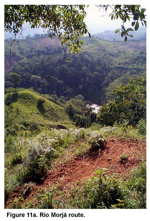
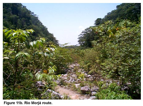
The shorter of the two routes between the El Paraíso valley and Quiriguá extends north-south along the Río Morjá (Morjá route: Figure 11a, shown above, and Figure 11b, shown below). This river begins at the confluence of several smaller creeks in the El Paraíso valley and flows north and northeast, debouching into the Motagua River. North of El Paraíso, it flows through a narrow gorge that eventually expands into a broad (2-3 km wide) valley known as the Morjá valley. The northern portion of the Morjá valley connects to the southern side of Motagua river valley. Therefore, the critical 7 km stretch between the El Paraíso and Morjá river valleys is hilly, with little flat terrain and no ancient settlement. Interestingly, even as the terrain opens into the wide and flat Morjá valley, there is little settlement. Heavy settlement is recorded only in the southernmost reaches of the Motagua river valley (see also Ashmore 1981). Overall, this route maps an 18-20 km course to the Motagua valley, taking the traveler ca. 3-5 hours to complete.
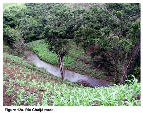
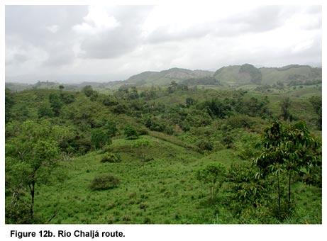
The second route runs along the Río Chaljá that flows northward from the northwestern corner of the El Paraíso valley (Figure 12a, shown above, and Figure 12b, shown below). It flows through a wider more traversable terrain that is less hilly, with wider patches of flatlands, and with settlement strung along the entire stretch between El Paraíso and the Motagua valley. As a route, it is more circuitous than the one along the Rio Morjá–ca. 25 km, taking ca. 6 hours to traverse. However, its flatter stretches make it a better candidate for transporting cargo. In fact, settlement along this route was also more frequent–two sites (of the Type I category) were located in a single kilometer stretch of the route.
From the qualitative comparison of the Morjá and Chaljá routes, it seems reasonable to suggest that the Morjá route would have been favored for rapid communication while the Chaljá route would have been used to transport goods and/or people. It is important to note that the Morjá route would have allowed daily communication between Quiriguá and El Paraíso–a fact that would prove helpful in characterizing the amount of autonomy and disengagement subordinate centers would have enjoyed from their overlords.
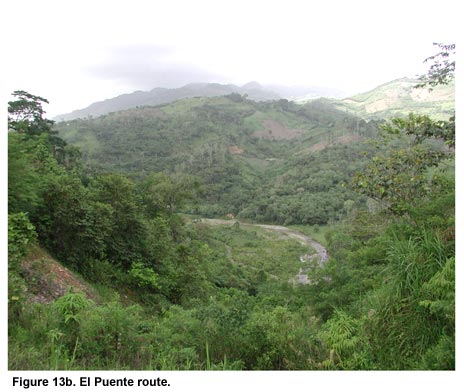
Little effort in 2003 was made to determine the eastern points of egress from the El Paraíso valley. The most likely route follows the Quebrada Rosario eastward (Figure 13a, shown above, and Figure 13b, shown below). However, the Chamelecón river valley represents yet another drainage system (with the major river flowing eastward rather than northward). There appears, therefore, no way to avoid passing through steep mountains when traveling between El Paraíso and the centers located in the La Florida and La Venta valleys. It is interesting that one of the major sites of the region–Las Pilas–is located at an egress point for the La Florida valley. Las Pilas is a large center similar to the El Paraíso site in architectural style and scale. This route likely measures ca. 20 km and would take roughly 4-6 hours to traverse on foot. More work on the eastern routes will be undertaken in 2004.
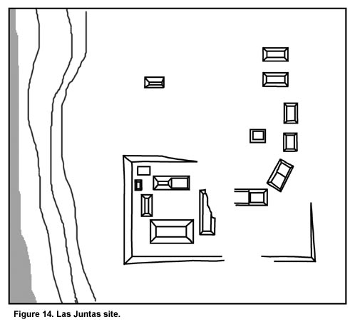
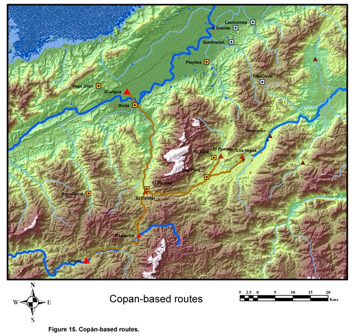
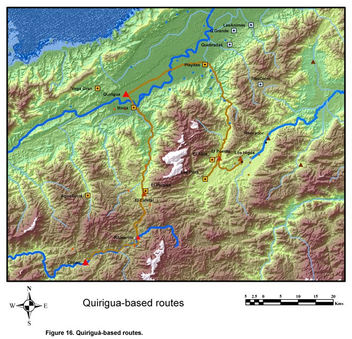
El Paraíso and Río Amarillo/Copán The routes that lead to Río Amarillo and Copán are more difficult to determine since there are several viable egress points from the El Paraíso valley leading south and west. Furthermore, due to geological patterns, Río Amarillo and Copán are also located in a different drainage system (in which rivers flow westward) from that of the El Paraíso valley. Therefore, any route from El Paraíso to either Río Amarillo or Copán traversed a highland pass separating the two drainage systems. Initial analyses suggest that the easiest and fastest route between the El Paraíso valley and Copán passed directly through the Río Amarillo valley. From Río Amarillo, the route would simply follow the Río Amarillo/Copán into the Copán valley. There seems to be no easy or short route that leads directly from El Paraíso to Copán. PAREP was able to recognize two egress points from El Paraíso leading south toward Río Amarillo, which lies roughly 10 km away. The first egress point runs along the La Pita river valley south of El Cafetal. This valley penetrates 1km into the mountains and then begins to climb to roughly 200 m in elevation. The route then runs through 3 km of broken mountainous terrain, emerging at the northernmost point of the gently sloped Río Blanco river valley where the large Type III rural site of Piedras Negras is located. In between Piedras Negras and Río Amarillo lie ca. 5 km of flat terrain. Reconnaissance in 2003 did not attempt this route–it was only reported to PAREP by local inhabitants who call it "La Cumbre." The local inhabitants claim the full trip from El Paraíso to Río Amarillo along this route takes roughly 4-6 hours. In 2004, this route will be investigated fully to determine if there is any settlement along the El Paraíso half of the route. The second egress point leads southward along the Ocote River, ca. 1 km to the east of the other southward route. This route was briefly inspected by PAREP. The survey located a large Type II site (ca. 12-15 structures) known as Las Juntas (Figure 14) ca. 4 km south of the El Paraíso site. Although the site is positioned near the half-way point between El Paraíso and Río Amarillo, it lies at the base of a cul-de-sac valley surrounded by steep mountain slopes. Therefore, from this point, it appears as if the route climbs east and links with the other route mentioned above. Las Juntas’s location might in fact not relate to exchange routes but rather might be related to the nearby presence of a natural outcropping of volcanic tuff, often used for the construction of ceremonial and elite structures. The precise location of this resource will be determined by PAREP in 2004. Copán lies ca. 25 km southwest of the El Paraíso valley. Routes leading southwest from El Paraíso run into mountains more difficult to traverse than those to the south. This direction has not been fully explored, so only preliminary conclusions can be offered. It seems likely, however, that this direction would be chosen as a communication route and not for cargo. Of the potential western egress points, the one following the Las Peñas River westward was partly investigated. Although settlement was encountered within a rolling hilly landscape without steep inclines near the El Paraíso valley, the route soon led into steep mountainsides inimical to frequent usage. Another potential route that has yet to be explored egresses the El Paraíso valley at its northwestern corner, along the Quebrada Las Flores and leading westward to the Río Managua valley. The Río Managua runs parallel to both the Chaljá and Morjá rivers. The Type II site of Agua Sucia lies ca. 15 m west of El Paraíso in the Río Managua river valley. From Agua Sucia to Copán, however, the route is due south and traverses a series of small river valleys and several mountain passes. The reconnoitering was not able to include this entire route, though reports suggested the entire trip from El Paraíso to Copán through Agua Sucia could be made in a total of 8 hours. Clearly El Paraíso is located no farther than 6-8 hours travel from the major Classic Maya centers of the southeastern Maya area–Copán, Quiriguá, El Puente, Los Higos, and Río Amarillo. In fact, this equidistance to the major centers of the region is unique to the El Paraíso valley. No other area in the region is as close to all the other regional monumental centers as the El Paraíso valley. This relationship suggests that the El Paraíso valley was an important node along the routes crisscrossing the region among Copán, Quiriguá, and the centers of central Honduras. What further elucidates El Paraíso’s importance to Copán is its location vis-à-vis Río Amarillo. The application to Río Amarillo of the same criteria for defining routes demonstrates that the easiest route from Río Amarillo to central Honduras also passes through El Paraíso. These data suggest that El Paraíso was the critical node (Figure 15) in Copán’s northeasterly route system while Río Amarillo was an important relay point along the route to El Paraíso. All goods leaving Copán were pipelined through Río Amarillo to El Paraíso. From El Paraíso, the goods could go either north to Quiriguá and the Petén lowlands or east to El Puente and central Honduras. Conversely, all materials destined for Copán were funneled through El Paraíso for final passage to Río Amarillo and then Copán. It seems as if the existence and location of secondary centers in both the Río Amarillo and El Paraíso valleys may be (partially) explained by spatial, distributional, and resource management analyses that posit Copán as the center of an exchange system. Although geological and topographic patterns determine neither political structure nor economic organization, the fact that political centers in this region are located in areas predicted by a Copán-centric exchange system model suggests some relevance to these criteria. However, the known conflict between Quiriguá and Copán (Martin and Grube 2000) might have resulted in activities that would render this model incomplete. In fact, the network of centers within this region is not without redundancy–that is, the routes that Quiriguá residents could choose to access central Honduras sites were not dependent on El Paraíso, as were those of Copán (Figure 16). Therefore, there arises the distinct possibility that primary and secondary centers in the southeastern Maya area might not comprise a single exchange network; rather there might have existed two distinct networks controlled by competing elites based at both Copán and Quiriguá. It appears now that at least some centers in the El Paraíso valley were likely strongly allied with Copán, given the latter’s dependence on these El Paraíso centers to secure access to the north and east. A more comprehensive analysis will eventually speak to this notion of competing exchange networks deriving from the shifting political alliances among the Classic Maya elites controlling these different centers. In other words, this region might provide a perfect opportunity to study the complex and vaguely understood notion of political boundaries between Classic Maya polities. The survey of the El Paraíso valley was designed to undertake 100% coverage within the 35 sq. km valley. The survey is meant to locate, record, and surface collect the remains of all ancient settlement as well as to record relevant ecological and geological attributes of the various sectors of the valley. Furthermore, the topographical mapping of defined portions of the valley sectors accompanied this survey. Specifically, the 2003 survey and mapping programs were meant to accomplish:
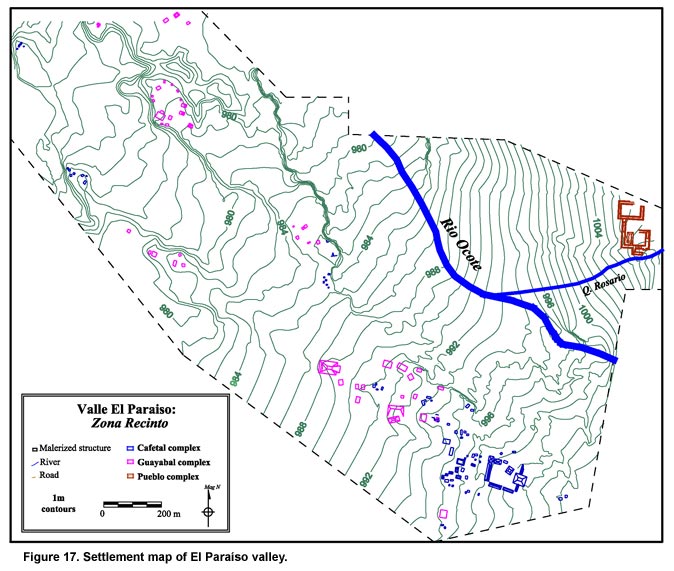
(1) Division of valley into survey "sectors"; description of limits and topography. A precise measurement of the El Paraíso valley has not been conducted yet because the necessary GIS data from the region was still unavailable in 2003. Consequently a rough assessment of the valley limits was derived from interpreting a USGS-style 1:50,000 topographic map of the valley. It was calculated that the valley covered approximately 30 square km–roughly an area measuring 6-7 km (north-south) and 4-5 (east-west). For the purposes of the PAREP survey, the valley was divided into 8 sectors–Ocote East, Ocote-Pita, Southern, Pita-Peña, Peña West, Las Flores, La Sardina, Morjá. These sectors were defined mostly by river boundaries and topographical features, though some consist of arbitrary limits. In 2003, survey was primarily limited to the Ocote-Pita sector, though narrow survey swaths on the eastern side of the Pita-Peña sector and the southern side of the Ocote East were also completed. The mapping efforts largely followed the survey areas. The mapping program was designed to fully map the two sectors within which the large centers are located (that is, the Ocote East and Ocote-Pita sectors). Overall these two sectors represent ca. 4 sq. km of the valley. In 2003, PAREP managed to complete a topographic map of ca. 50% of this area (Figure 17). In future seasons, the mapping program will finish the topographical mapping of these two sectors while the survey will expand beyond them to the rest of the valley. The results of both the mapping and survey programs can be seen in Table 1, below. Aside from these site totals, another 14 sites (76 structures) were recorded during reconnaissance outside of the El Paraíso valley along the various trade routes discussed above.
It is clear from Table 1, shown above, that the PAREP survey has covered only a small portion of a minority of sectors. Therefore, the low number of sites reflects the limited range of the survey rather than a low settlement density. Settlement density, calculated as a function of the total surveyed area (ca. 3 sq. km), equals 58 Strs./sq. km. Though not a dense number, this average is equal to settlement in the Río Amarillo valley (Canuto 2002) and in some sectors of the Copán valley (Fash 1983). However, this measure assumes contemporaneity among all the registered sites; given certain architectural features, this conjecture might prove false after future test excavations. Measured as a function of the variety of site types within the surveyed area, settlement complexity proves important. The sites in the region have been categorized by a hybrid typology derived from research in the Copán, Río Amarillo, and La Venta valleys (Canuto 2002; Leventhal 1979; Nakamura et al. 1991; Webster 1985).
Curiously, the El Paraíso valley shows an absence of Type III and IV sites–those that, in the Copán valley, likely represent the residential compounds of the Copán elite, likely residences of the lineage heads of the Copán polity (Sanders 1989) or of a secondary elite charged with administrative duties in support of the ruling dynasty (Jackson and Stuart 2001). It is likely that the absence of these elite residential compounds in the El Paraíso valley results from the conflation in this area of the regional political center (the Type V site) and the residences of the local elite. As for the lower orders of the site typology, typically residential sites are abundant, suggesting that the majority of the population in the area was agrarian and organized into kin-based socio-economic units. The reconnaissance along the various routes outside the El Paraíso valley also encountered several sites, 12 mounded sites and 2 artifact scatters. The remarkable attribute of this settlement, however, was that it contained a high percentage of large sites–that is, 50% were either Types III, II or I. This number roughly doubles the concentration of these same types within the El Paraíso valley (i.e., 27%). This difference might derive from the fact that reconnaissance methodology outside the valley is less likely to record smaller sites than the survey methodology within the valley. However, there remains the possibility that the higher than expected complexity of settlement along the routes relates to their regional importance and special function. Excavations at a sample of these "route sites" will help determine if and how their inhabitants were involved in regional trade. During the 2003 season PAREP members were also able to test and modify a hypothesis developed from the preliminary research in 2002 regarding the El Paraíso valley’s settlement pattern. Survey had determined, despite being hampered by intensive modern usage of the land (such as coffee plantations and tobacco farming), that settlement was limited to the alluvial terraces that parallel the multiple rivers in the valley. The alluvial terrace along the western bank of the Río Ocote ranges from 1-5 m above the floodplain of the river. In 2003, to test this hypothesis, survey concentrated on following this alluvial terrace as it paralleled the Río Ocote. Consistent with the preliminary finds from 2002, sites were recorded along this entire stretch of the alluvial terrace while none were found on the floodplain. This pattern was then replicated along the Pita River’s eastern alluvial terrace. On average, sites found along the alluvial terraces were located roughly 200-300 m from a river. The degree to which these river courses have shifted in the last millennium remains unknown. Therefore, many of sites located along the terraces might have been somewhat closer to the rivers than today. In any case, from these initial observations, it would appear that inhabitants within the valley showed great discretion regarding the placement of their structures–favoring higher better-drained terrain over proximity to the rivers, though on average sites are only a few hundred meters from a permanent water source, in any case. Furthermore, water in the valley is both plentiful and ubiquitous; therefore, it is likely that water posed a limit to settlement location only in terms of drainage and not in terms of supply or access. The only exception to this general settlement pattern norm is the site of El Paraíso itself, which lies directly on the northern bank of the Quebrada Rosario–a river that has indeed cut away some of the southern patio groups of the site. In fact, El Paraíso exhibits numerous architectural features that suggest that water-management and drainage were critical to the site–a set of architectural features unique to this valley. Furthermore, reports of artifacts and stone masonry to the east of the large El Paraíso center suggest that there existed an extensive (and now largely destroyed) Classic period settlement along the entire length of the Rosario River. If settlement patterning and site location prove reflective of group identity and affiliation, then it could be argued that the deviation from the settlement pattern norm exhibited by settlement surrounding the site of El Paraíso might indicate important differences among the inhabitants of various portions of the valley. Alone, however, these attributes do not prove that the El Paraíso valley was inhabited by distinct coeval groups. This unknown remains one of the questions PAREP research will address. In terms of spatial patterning, PAREP has adopted a typology that attempts to describe both an inter and intra-scalar variability among sites. Inter-scalar variability uses the following terms:
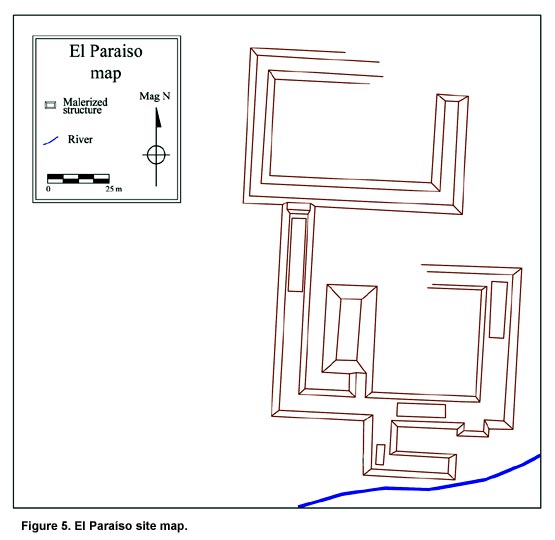
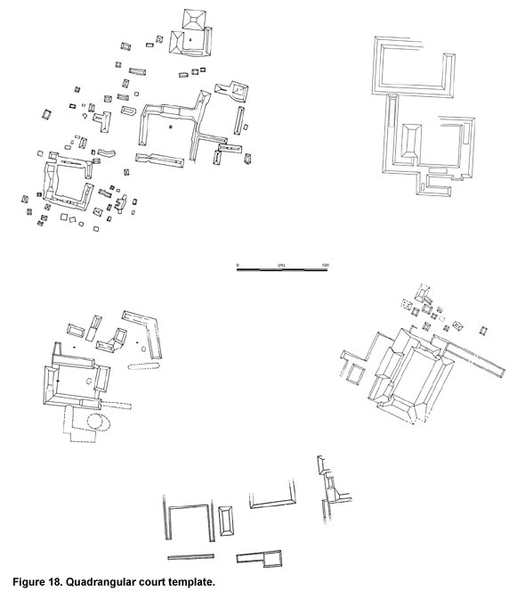
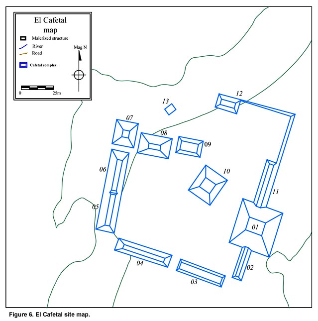
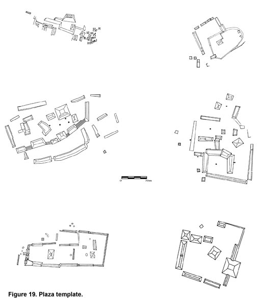
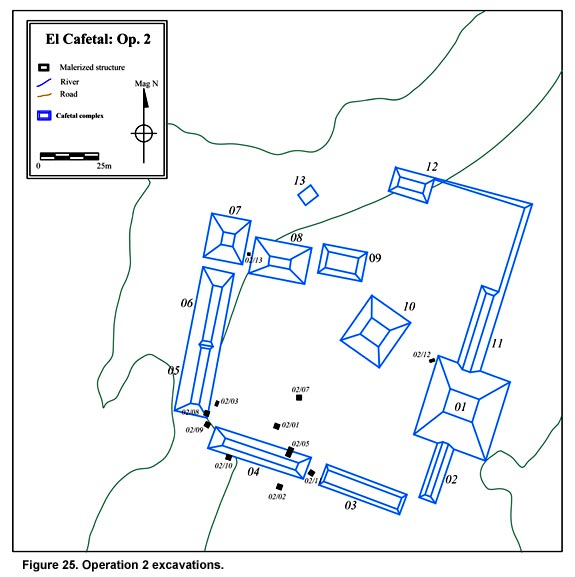
For intra-scalar variability–especially with respect to the agglutinated patio-focused cluster (Site Types IV and V)–the terms quadrangular court and plaza are used. These terms point to sites that display a quadrangular organization of structures varying in terms of accessibility, proportion, and formal planning. Since the survey has covered only a small percentage of the region, it is likely that many more small sites (Type III and smaller) will be encountered in the upcoming seasons of fieldwork. At the moment, however, it appears as if these smaller sites are organized as patio groups. Very few isolated mounds were encountered. Furthermore, the larger of these sites seem to be patio-focused clusters, that is, a central patio is surrounded by dispersed structures not necessarily organized into patio groups of their own. In terms of the monumental centers of the region, however, the survey has likely recorded the majority (if not all) of those located in the El Paraíso valley. Therefore, some preliminary comparisons are possible. The four largest sites–El Paraíso, El Cafetal, El Guayabal, and Las Orquídeas–are organized in highly distinct patterns. The latter two centers exhibit an earthen masonry that suggests a Late Pre-Classic origin. Las Orquídeas is a compact site built along an alluvial spur of the Pita River. Its earthen structures are located along the perimeter of this spur, forming a loose plaza that closely resembles the sites of Los Achiotes and Cerro Chino in the Río Amarillo and Copán valleys. El Guayabal’s structures are also earthen and they too form (at a much larger scale) a loose plaza space. Although not identical to Las Orquídeas, it appears as if El Guayabal belongs to a similar spatial and architectural tradition. The Late Classic centers of El Cafetal and El Paraíso, however, are extremely different from these earlier centers in terms of both their stone masonry and site planning. More importantly, however, these two centers differ from each other in profound ways, despite the fact they are located less than 2 km apart and are generally contemporaneous. This curious fact might suggest that the El Paraíso valley was host to two distinct architectural and spatial traditions during the Late Classic. El Paraíso (Figure 5) consists of several enclosed patios and several quadrangular courts. It seems to follow certain proscriptions of the QP3 quadrangle pattern recognized by Ashmore (1981) and Schortman (1991). The site is centered around a court with a sunken patio surface dominated on its western side by a tall pyramidal structure (formerly approximately 12 m in height). Two other courts are located to the north and northeast. To the south of the large pyramidal structure, several enclosed patios separate it from the nearby Quebrada Rosario. The same construction styles that Schortman (1991) described for the Lower Motagua valley sites dating to the Late Classic–such as the "stepped" pyramid and schist-slab techniques of construction–also apply. Furthermore, the major spaces were entirely enclosed like many of the LMV quadrangle groups were. However, El Paraíso differs from LMV settlement in many respects as well. Specifically, it also displays several elite Maya-style attributes, such as cut-stone masonry (volcanic tuff), Copán-style architectural sculpture, stuccoed façades, and plaster floors. In large part, this center seems to resemble the sites of Morjá (Ashmore 1981), Las Playitas (Schortman 1991), Las Pilas, and El Abra (Nakamura et al. 1991) in terms of its quadrangular court plan (Figure 18). El Cafetal (Figure 6) consists of ten monumental structures that define a large plaza (approximately 150 x 110 meters) oriented slightly east of magnetic north. The central plaza is dominated on the east by a large ten to twelve meter high terraced pyramid. This pyramid is flanked by two fifteen to twenty-five meter long range structures that rise roughly two meters in height. Together, these three structures make up the eastern limit of the plaza. To the south, the plaza is defined by two very long range structures (thirty to thirty-five meters each), each of which rises roughly two meters. To the west, the plaza is delimited by two connected range structures that measure roughly twenty to twenty-five meters each in length, and rise higher than the similar structures on the south, to about three to four meters in height. The northern edge of the plaza is composed of three stand-along pyramidal structures. The two located nearest the northwest corner of the plaza are five-meter-high. Farther to the east of these two, separated by roughly twenty meters, lies another structure rising four meters. Its axis points almost 45 degrees east of south. This structure is the most off-axis mound of the whole group. Surrounding this plaza are located ca. 50 structures organized in smaller patio groups or clusters. In terms of planning, this site most resembles El Puente and Las Tapias from the La Florida valley (Nakamura et al. 1991) as well as Bobos in the Lower Motagua valley (Schortman 1991). This site plan seems to be a loose variation of the QP3 pattern defined by Ashmore (1981). However, given the variation within this type, it might prove instructive to try to further define this common type for this entire region. Although defining a quadrangular space, El Cafetal’s structures are of cobble masonry forming long and narrow terraced range structures that likely supported only perishable structures. Unlike the "stepped" technique from the LMV, these structures are raised by the construction of multiple low (2-3 courses of stones) and wide terraces (ca 75-150 cm). Architectural sculpture, stuccoed façades, and plaster floors are entirely absent. In large part, this center seems to resemble the sites of El Puente, Los Higos, Roncador (Nakamura et al. 1991), Piedras Negras (Vlcek and Fash 1986), and perhaps even Río Amarillo (Saturno 2000) in terms of its loose plaza plan (Figure 19). In 2003, surface collections were made at 13 different sites. Although a more comprehensive analysis of these items remains incomplete, the initial analysis showed a remarkable co-variance between abundant surface collections and cobble masonry. That is, the earthen structures have fewer artifacts on the surface. This distinction cannot be satisfactorily explained without more extensive research of these sites. However, a comparison of the remains between cobble/cut stone masonry and earthen sites confirms the temporal differences alluded to in the above section: the presence of two distinct occupations in the El Paraíso valley–from both the Late Formative and Late Classic periods. In terms of the Late Formative, the data remains ambiguous. Given circumstantial evidence and comparative data from other parts of the region, it would seem likely that the sites of El Guayabal and Las Orquídeas date to some time before the Classic period. Exactly when, and whether these two sites are coeval, and the cultural traditions to which they belonged remain unknown. Furthermore the extent of this Pre-Classic settlement is also unknown. As of 2003, any site exhibiting earthen architecture was deemed Late Pre-Classic. This conjecture will require much further testing in forthcoming seasons. The Classic period surface collections from the El Paraíso and El Cafetal regions suggest a general affinity of the region with Copán’s Coner phase ceramics. Beside fine wares such as Copador and Surlo, more mundane and utilitarian types such as Masica, Raul, and Casaca were also identified. It will be important to define the frequency and distribution of these types once PAREP initiates larger excavation programs. Such studies will help determine not only what differences the El Paraíso and El Cafetal assemblages have between each other, but also their regional affinities. In sum, the preliminary results of the 2003 season suggest that the El Paraíso region saw two major occupations–one in the Late Pre-Classic and another in the Late Classic. There is little evidence to suggest continuity between these two periods. Little can now be concluded about the Pre-Classic occupation, though some tantalizing architectural consistencies suggest that the valley of El Paraíso might have played a critical role before the rise of Copán to its southwest. In regards to the Classic period population, it was likely equivalent in overall size and extent to that of adjacent parts of this region. Moreover, its composition and likely basis for organization was not particularly different. The major centers controlling this population exhibit some intriguing and profound differences with one another; however, they follow patterns already extant throughout the region, especially to the east and north. It seems as if the El Paraíso valley might prove to be a microcosm of some of the regional diversity that has long been the focus of interpretive models of the area (e.g. Schortman and Nakamura 1991). The profound differences between El Paraíso and El Cafetal are rendered more interesting by the fact that they are located in such a critically important valley in a region crowded with competing elites. Could these two sites be outposts of competing factions? Could they be reflective of broader ethnic differences? Could this valley represent a "ground-zero" for interregional trade? These questions will form an integral part of future research. Finally, a cautionary note seems warranted here, as only 10% of the valley has been surveyed. Further research will undoubtedly modify, if not contradict these preliminary observations. Test excavations were conducted at both El Paraíso and El Cafetal. The excavations were limited to small exposures of terminal phase architecture or off-structure middens. Given PAREP’s limited scale of operations in 2003, these excavations were strategically designed to recover specific pieces of information that would then aid in the development of a larger, broader excavation program. Specifically, the excavation program was designed to:
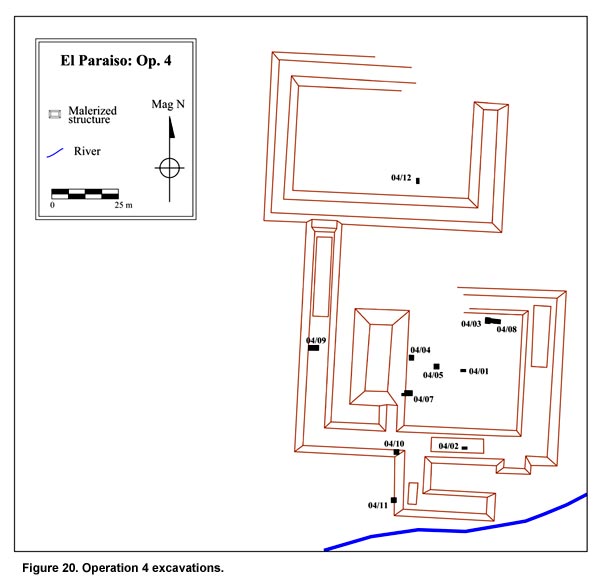
The excavations at El Paraíso (Figure 20) were beset by a set of unique challenges requiring the excavators to undertake other roles beyond that of researchers. Much of the ancient site is located under the modern town of El Paraíso. This unfortunate coincidence has caused the destruction of large parts of the site. Furthermore, much of our work was spent in the private property of the people currently living "on the site." This situation required a more delicate and socially sensitive approach to our excavation strategy. As alluded to above, many of the research activities undertaken by PAREP were accompanied by necessary accommodations and outreach activities within the local community. Although not treated in any detail within this report, these activities were critical to PAREP’s continued success. During the excavations of El Paraíso, these community activities were archaeologically significant because they pertained directly to the processes of destruction that have so modified (perhaps irretrievably) this site. Therefore, in addition to the goals mentioned above, the excavations at El Paraíso also involved canvassing local people living on the site about artifacts found, pits dug, and stones removed from the site. Through their descriptions and memories of the way the site looked as much as fifty years ago, PAREP personnel were able to reconstruct a tentative map of the site as well excavate in areas that would have otherwise been considered off-limits. The close collaboration with the community members that PAREP has cultivated represents one of the many ways community interaction can lead to positive results, both academically and socially. The excavations in 2003 were conducted in Patios 1, 3, and 4. Overall eight (2x2 m or 2x1 m) test units were placed at key locations throughout the site. The details of each unit will not be summarized here, given the lengthy detail that this would require (for this information see Canuto and Bell 2003). What follows, however, will be a summary of the information that these various excavations gathered. Namely this section will focus on: (1.) dating (chronology and construction phases), (2.) architecture (construction, style, and decoration), (3.) special features (cists, burials, caches), and (4.) material culture (midden deposits, ceramics, lithics, and special objects). Although no radiocarbon samples have yet been tested, El Paraíso can be confidently dated to the Late Classic period, A.D. 600-850 based on the presence of certain diagnostic ceramic. Certainly, the occupational span for El Paraíso could be longer; however no clear evidence of Early Classic or Late Pre-Classic ceramics has been recovered. Excavations have, however, not been able to reach sterile soil in some parts of the site because of a ground-water problem. At roughly 60-100 cm below the modern surface, water begins to seep into the excavation units, hindering further excavations. Future work will attempt to locate an area where excavations can proceed into sterile soils without encountering ground-water, to determine the full extent and age of El Paraíso’s earliest phase.
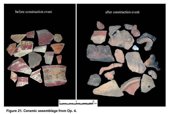
From the excavations thus far completed, the most chronologically diagnostic ceramic types recovered at El Paraíso include the cream-pasted Copador with specular hematite decoration (Figure 21, before construction, shown above). This highly distinctive type characterizes the early facet of the Coner ceramic phase at Copán–ca. A.D. 650-750 (Bill 1999; Viel 1993). At Copán, this ceramic type rapidly declines in frequency in the mid-8th century, becoming virtually absent by A.D. 800. In part, its absence triggered the definition of a late facet of Coner in which other elite types (like the black-brown pasted Surlo bowls) register a higher frequency. At El Paraíso, a similar rise and decline of Copador frequency occurs in conjunction with a massive construction event that transformed much of the El Paraíso center. Excavations in Patios 1, 2, and 3 all found evidence of two patio floors. The earlier of the two floors was made of wide and smoothed cobbles covered by a thin plaster coating. The later floor was a 5-7 cm thick plaster floor. Between these two floors lies ca. 75 cm of river cobble and loose dirt fill. It is clear by the consistency of this two floor stratigraphy throughout Patios 1, 3, and 4 that the earlier floor was buried in a single, concerted, and massive construction event at El Paraíso. Furthermore, new constructions or renovations of older buildings would have been required with the re-paving of most of the site’s enclosed patios. All of the Copador ceramics were associated with the earlier (lower) floor. The fill that buried this floor and then the second floor laid anew had no evidence of Copador ceramics (see Figure 21, after construction). This stark contrast suggests that El Paraíso might have been remodeled and enlarged during the late facet of the Coner ceramic phase, that is, some time after A.D. 750. The architecture of the site proved to be an interesting mix of local accommodations and regional styles suggestive of the elite’s affiliations. Excavations within Patio 1 were located in the northeastern corner to reveal the southern (internal-to-the-patio) façade of the northern platform of Patio 1. Another set of units was located near the eastern façade of Str. 1.
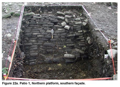
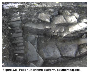
The first set revealed a construction technique that utilized the locally available schist, in the form of flat slabs, to build the internal façade of the northern platform. These slabs were very thin–5-10 cm thick–requiring 10-15 courses to construct a ca. 1 m high façade (Figure 22a, shown above, and Figure 22b, shown below). This technique is somewhat reminiscent of the "schist-slab" technique defined by Schortman (1991) as typical of the Lower Motagua valley centers. Furthermore, this lower façade exhibited a pronounced batter–almost to the point of looking like a ramp. Stairs consisting of four steps led from the Patio 1 floor to the surface of this platform and were constructed with faced cobbles. No stucco was associated with this platform façade.
On the western side of Patio 1, excavations revealed the easternmost and lowest two steps of a central staircase leading to the summit of Str. 1 (a formerly 10-12 m high structure). These steps were also composed of roughly cut river cobbles. At the base of these stairs, strewn on Patio 1’s stucco floor, numerous pieces of volcanic tuff, some cut and faced and some sculpted, were recovered. These pieces suggest that Str. 1 represented a terraced pyramidal platform with a superstructure decorated with sculpted façades. As such, Str. 1 was constructed and decorated in the style typical of monumental non-residential buildings at both Quiriguá and Copán. As mentioned above, the date of the construction of Str. 1’s terminal phase probably dates to the late Coner phase–ca. A.D. 750-800.
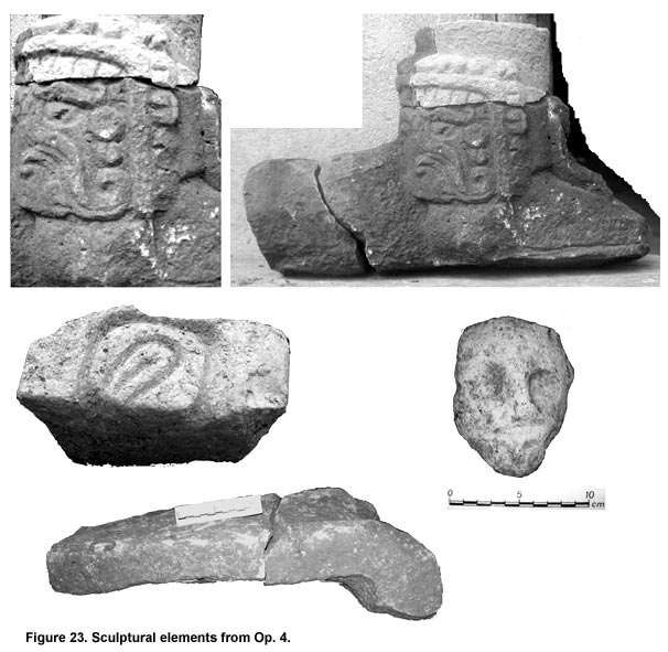
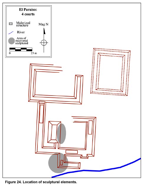
Excavations to the south of Patio 1 focused on the construction of buildings ancillary to Patio 1. Although the excavations did not reveal architectural façades, they did recover both cut and sculpted blocks of volcanic tuff. These finds suggest that both residential and ceremonial buildings at the site were decorated with architectural sculpture (Figure 23, shown above). In 2003, sculptural elements were found in two separate locations (Figure 24), suggesting that many of the structures built during the major late Coner construction event were graced with architectural decoration in the style of the elite Maya of the region. A final excavation unit in Patio 4 revealed the presence of only one floor–a cobble pavement that corresponds both in style and elevation to the earlier of the two floors from Patios 1, 2, and 3. Because Patio 4 is wider and longer than its southern counterparts, it is better classified as a "court" than either a quadrangular or enclosed patio. Furthermore, it shows no evidence of the construction event that transformed the southern half of the center. It is possible that Patio 4 provides a model for how Patio 1 might have appeared before it was entirely renovated. Interestingly, Patio 4 and a hypothesized Patio 5 (now completely buried by the modern town) resemble the Lower Motagua valley sites like Las Quebradas and Quebrada Grande in form, proportion, plan, and architectural style. Excavations in 2003 found no special features or deposits of note. Because the excavations were designed only to reveal terminal phase architecture and probe patio spaces, concerted effort was made to locate units in areas where such features (burials, cists, caches, deposits) were not likely to occur. Future excavation designs, however, will include these features as a priority. The analysis of the materials recovered in the course of the El Paraíso excavations has barely begun. Therefore, only broad and general comments are currently warranted. As part of a general description, it can be claimed that the 2003 excavations recovered a broad variety of material culture from the site, despite failing to find any clear refuse deposits. Consequently all the recovered material was encountered in either architectural fill or tumble contexts, likely far removed from their primary use areas. The absence of any primary contexts in the El Paraíso excavations hampers a more detailed analysis. Future excavations will attempt to rectify this problem. Generally speaking, the excavations found both utilitarian and fine ware ceramics. In both cases, the types and modes resembled those commonly found at both Quiriguá and Copán. Other types, such as Masica incised, are typical of a central Honduran ceramic tradition. Further studies of ceramic type frequency rates at El Paraíso will help determine the extent to which El Paraíso’s type and modal similarities relate to the affiliations of its inhabitants. Other than traditional ceramic vessels, a variety of special function objects–such as modeled incensarios, candeleros, perforated human teeth, jade and bone beads, and ceramic stamps–suggest a variety of ritual and elite activities. Given their recovery in secondary contexts, few specifics can be said about the activities or behaviors of the El Paraíso elite. However, it can be claimed that its leaders did engage in a series of decorative practices and ceremonial rituals that are consonant with those of the Classic Maya elite of the Late Classic period. In regards to the cream-pasted Copador fine ware, its presence at El Paraíso has implications that extend beyond the site’s chronology. It is interesting to note that from A.D. 650-750, this ceramic type is abundant throughout the Copán, Río Amarillo, El Paraíso, La Florida, and La Venta valleys, but virtually absent at Quiriguá and the Lower Motagua valley. In fact, the presence of Copador follows the easterly route from Copán to central Honduras. To that extent, its presence at El Paraíso would suggest its relevance to a Copán-based exchange route during its initial phase of construction. However, the complete absence of this Copador type after the center is remodeled suggests an abrupt change in the material culture the inhabitants of El Paraíso acquired. Although Copador declines during the late facet of Coner, the El Paraíso evidence currently suggests an abrupt decline–as if an embargo had been imposed. From the 2003 excavations, it is clear that the site of El Paraíso demonstrates a complex web of similarities and contrasts. Some of its architectural style and site plan resembles those at sites in the Lower Motagua valley. The material culture suggests that El Paraíso played an important role as a node along the Copán-Quiriguá trade route. However, after A.D. 738, it seems clear that the rulers of Quiriguá and Copán grew inimical to each other’s interests. Curiously, it is at this time that El Paraíso undergoes a massive construction event that leaves it larger, more massive, and heavily decorated with elite Maya-style architectural sculpture. It is reasonable to suggest that this construction episode did not just coincide with these regional events; rather it was a consequence of the El Paraíso ruler’s affiliation with one side in this political conflict. Interestingly, this alteration of the center was not an isolated event in the Copán-Quiriguá hinterlands. Another center in this region, Río Amarillo, exhibits a similar spurt of construction and elite activity during the late Coner period. In the case of Río Amarillo, major construction involved the repaving of the entire central plaza space and the erection of a building with architectural sculpture. These major renovations and embellishments to the center, date to the reigns of the last two dynasts of Copán (A.D. 749-822; Saturno 2000) and clearly associate this center with Copán. The contemporaneous and equivalent architectural developments at Río Amarillo occur at a time during which (1.) Copán was re-establishing its regional dominance after having lost a war with Quiriguá in A.D. 738 (Sharer 1991), (2.) Quiriguá’s hard-won autonomy and regional pre-eminence allowed its elites to expand their interests, and (3.) regional elites had the opportunity to express their independence from both polities. In this context, it would be interesting to determine whether centers like Las Pilas and El Abra in the La Florida valley also underwent a spike in construction activity during the late Coner. Although Río Amarillo’s allegiance to Copán is well-documented, it is currently difficult to propose with any confidence that El Paraíso’s elite had allied themselves to the Quiriguá rulers. However, certain facts do suggest this possibility. The abrupt decline (exclusion?) of Copador ceramics after the site’s reconstruction might be one small indicator. Furthermore, when El Paraíso is compared to other hinterland centers, it seems to be consistent with other Quiriguá-based centers. In fact, El Paraíso represents one of a series of quadrangular court style centers located along the Quiriguá-to-Chamelecón trade route. These quadrangular style centers are Morjá, El Paraíso, Las Pilas, El Abra, and Playitas (see Figure 1). Moreover, they share some important architectural and decorative traits. They all have architectural sculpture, stuccoed façades, and plaster floors. As Quiriguá-based outposts, they would have provided Quiriguá’s rulers stable access to the Chamelecón drainage and central Honduras. Unlike El Paraíso, the site of El Cafetal is located far from any modern construction. It displays an almost remarkably well-preserved set of monumental structures. Its only modern disturbance has come as a result of coffee cultivation. Given recent changes in the international coffee market, the current owners of the land on which this site sits acquiesced to our request to clear the land of now old and under-producing coffee trees. This recent clearing has facilitated our ability to work at this site. In 2003, eight excavation units (2x2 m or 1x2 m) were located along the façades of three major structures (Strs. 1, 4, and 5), in the center of the plaza, and in-between several structures (Figure 25). As in the case of El Paraíso, the details of each excavation unit will not be recounted here (for this information see Canuto and Bell 2003). What follows is a synopsis of the data gathered from these excavations in the same sub-headings as above–that is, (1.) dating (chronology and construction phases), (2.) architecture (construction, style, and decoration), (3.) special features (cists, burials, caches), (4.) material culture (midden deposits, ceramics, lithics, and special objects). The chronologically diagnostic materials recovered from the 2003 excavations include some of the same materials found at El Paraíso. Copador ceramics were relatively abundant throughout the excavations. Unlike in the case of El Paraíso, no evidence of multiple construction phases was encountered. Therefore, in the absence of both clear stratigraphic evidence of multiple construction phases and reliable statistics on changes in ceramic type frequencies, it proves difficult to determine the full extent of this center’s occupation in the Late Classic. It clearly was extant during the early facet of the Coner phase. Furthermore, a qualitative assessment of the two potential refuse deposits excavated in 2003 suggests that El Cafetal was inhabited throughout the second half of the Late Classic period, during the time Copador ceramics declined in abundance. It appears, therefore, that El Cafetal is roughly contemporary with El Paraíso.
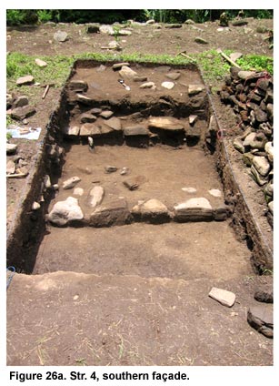
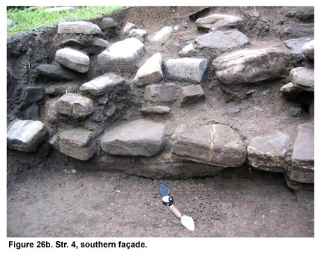
As discussed above, survey had already recognized a significant difference between El Cafetal and El Paraíso–characterizing the former a plaza site rather than a court. Excavations that revealed El Cafetal’s architecture proved that its difference from El Paraíso extended far beyond spatial plan. El Cafetal’s range structures are built as a succession of wide low terraces rising ca. 50 cm (Figure 26a, shown above, and Figure 26b, shown below). These terraces are built using cobble stones, some of which are partially faced. No volcanic tuff or schist slabs were used for the construction of the range platforms. Furthermore, excavations found no evidence of stucco covering the terrace façades.
Excavations recovered large amounts of burnt clay–daub–mixed within the architectural material that had tumbled from the range structure summits. This material suggested that these range structures supported perishable superstructures on their summits. Furthermore, the length of these range platforms suggests that they could have supported several perishable structures aligned to along the platform’s long axis. Future excavations to explore the summits of these range structures will allow us to better determine the nature of their superstructures. No architectural sculpture was recovered. Excavations within the center of the large plaza revealed that no formal floor had covered the plaza space. Excavations both adjacent to and distant from the structures failed to find evidence of a formal floor. It is likely that the plaza space of El Cafetal consisted principally of an earthen surface that might have been paved in sections–with the pavement most likely having been made of cobbles. A cobble pavement was revealed between Strs. 7 and 8. This area forms a 2-3 m wide space that allows access to the plaza from its northwest corner. Perhaps this pavement (the extent of which remains unknown) signals an official entryway into the plaza. Excavations in 2003 found no objects or materials in-situ. No caches or architectural features were recovered. However, between Strs. 4 and 5, a rich deposit of artifacts was excavated that suggested its function as a refuse deposit. In this case, this midden might prove to be the only primary context (transposed) recovered in the 2003 PAREP excavations. Its location between two large structures, at the southwest corner of Cafetal’s plaza, also proved somewhat unexpected. Curiously, excavations "behind" the Str. 4 found no evidence of refuse deposition. The material culture from El Cafetal was recovered from several significant refuse deposits located in between the major range platforms along the southern and southeastern sides of the center. Future research will have to undertake a much more careful and systematic analysis of both these middens, as, currently, only a qualitative presence/absence analysis has been completed. This initial study, however, has demonstrated that the important inhabitants of El Cafetal belonged to a regional exchange system, most likely controlled by Copán.
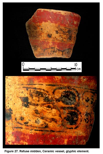
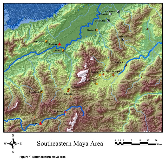
The presence/absence study has shown that these refuse deposits contained several items diagnostic of participation in Copán-sponsored interaction. Not only were plentiful amounts of Copador ceramics recovered, but several fragments of a polychrome-painted vessel with hieroglyphic script (possibly one of the Petén polychrome types) were also found (Figure 27, shown above). On this specimen, the text was only partly decipherable; it consisted of a "vulture"-head glyph that has been interpreted to mean ajaw. The glyphs that followed the vulture-head were missing, so no more information regarding the subject of the text can currently be known. However, the implication of this text cannot be underestimated. It plainly suggests that the residents of El Cafetal–and likely the owner of this particular vessel–had been deemed worthy of elevated status among elite Classic Maya society. As further indication of their elevated status, pieces of personal adornment such as jade, shell, and modeled-carved ceramics were also recovered. Accompanying these markers of Copán-based elite activity, the rest of the ceramic assemblage can be qualitatively described as central Honduran in style. There was an elevated number of incised-in-zones and filleted types (Cementerio Incised, Masica incised) that are commonly found at sites in central Honduras and are less frequent at centers in the Lower Motagua valley. Given the different architectural and spatial aesthetic that El Cafetal exhibits and the many attributes it shares with El Puente, it is tempting to suggest some type of affinity between the leaders or inhabitants of both centers. Nakamura et al. (1991:88) have already claimed that El Puente reflects a spatial aesthetic atypical of a Classic Maya center. They further maintain that the largest center of the neighboring La Venta valley, Los Higos, also exhibits a similar site plan. They propose that both centers reflect a spatial aesthetic similar to sites like found farther east, in the Quimistán valley and in central Honduras. If true, these associations imply that El Cafetal belonged to a local architectural tradition distinct from both the Lower Motagua and Copán valleys. Nakamura et al. (1991) do claim, however, that El Puente was strongly allied with Copán despite the obvious differences in architectural planning. Their recovery of plaster floors, architectural sculpture, decorative glyphic elements, stuccoed façades, and the use of dressed volcanic tuff lead them to surmise that El Puente was an important Copán ally in the La Florida valley. Furthermore, the site of Los Higos consisted of several altars and a Classic Maya style stela dating to A.D. 781. Similarly (but at a much reduced scale) the material culture at El Cafetal strongly links it to a Copán sphere of influence. The architectural, spatial, and directional attributes of these three sites argue against an obvious emulation of a Late Classic Maya (elite) aesthetic at the time of their initial construction. Through their prolonged existence, it appears that they received, donned, or had imposed multiple tell-tale signs of elite Maya culture of the Late Classic. These sites, in fact, might reflect the existence of a distinct architectural (cultural?) tradition of this area whose long-term interaction with Classic Maya centers like Quiriguá and Copán resulted in the adoption of some icons of elite identity. In such a scenario, El Cafetal reflects this impact only in the form of portable objects (though future excavations might prove this influence to be somewhat more extensive). Perhaps the process of adopting elite Classic Maya traits by these centers parallels how centers like El Paraíso initially resembled Lower Motagua valley quadrangular centers but eventually received Maya-style embellishments and decorations. | ||||||||||||||||||||||||||||||||||||||||||||||||||||||||||||||||||||||||||||||||||||||||||||||||||||||||||||||||||||||||||||||||||||
|
Text links to all pages at this site are available at the FAMSI INDEX |
||||||||||||||||||||||||||||||||||||||||||||||||||||||||||||||||||||||||||||||||||||||||||||||||||||||||||||||||||||||||||||||||||||
