| |
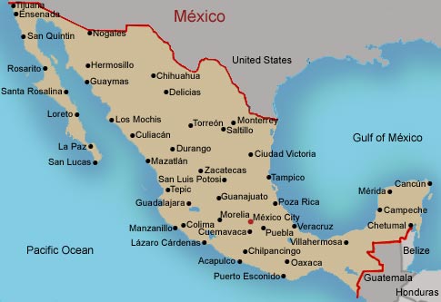
Map of México
 |
 |
Click flag for larger image. |
| Capital: |
México (Distrito Federal) |
| Administrative Divisions: |
31 States (estados, singular - estado) and 1 federal district (distrito federal); Aguascalientes, Baja California Sur, Campeche, Chiapas, Chihuahua, Coahuila de Zargoza, Colima, Distrito Federal, Durango, Guanajuato, Guerrero, Hidalgo, Jalisco, México, Michoacán de Ocampo, Morelos, Nayarit, Nuevo León, Oaxaca, Puebla, Querétaro de Artega, Quintana Roo, San Luis Potosí, Sinaloa, Sonora, Tabasco Tamaulipas, Tlaxcala, Veracrus-Llave, Yucatán, Zacatecas |
| Population: |
103,400,165 (July 2002 est.) |
| Ethnic Groups: |
Mestizo (Amerindian-Spanish) 60%, Amerindian or predominantly Amerindian 30%, white 9%, other 1% |
| Languages: |
Spanish, various Mayan, Náhuatl, and other regional indigenous languages |
|
| Maps by: |
|
| |
Country: |
| |
Belize El Salvador Guatemala Honduras México |
| |
Culture Area: |
| |
Main Mesoamerican Map
Central Plateau Gulf Coast Maya North West Oaxaca |
|