| |
Investigating an Inland Maya Port:
The 2003 Field Season at Trinidad de Nosotros, Petén, Guatemala
List of Figures
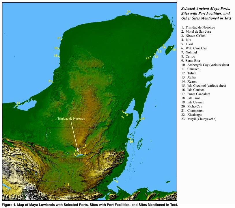
Figure 1. Map of Maya Lowlands with Selected Ports, Sites with Port Facilities, and Sites Mentioned in Text.
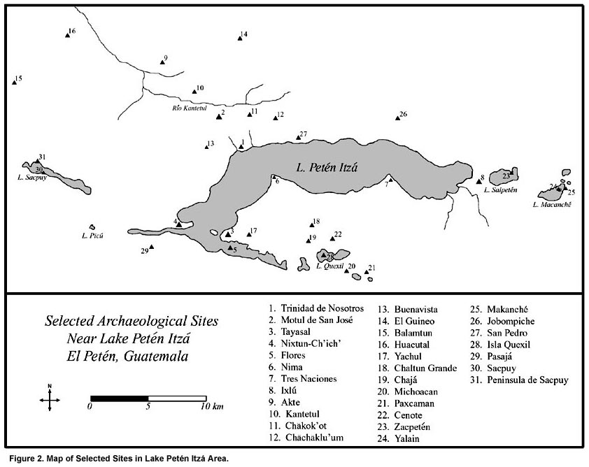
Figure 2. Map of Selected Sites in Lake Petén Itzá Area.
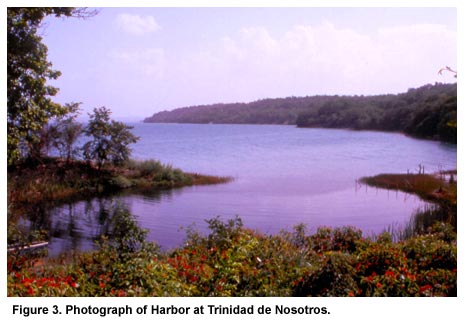
Figure 3. Photograph of Harbor at Trinidad de Nosotros.
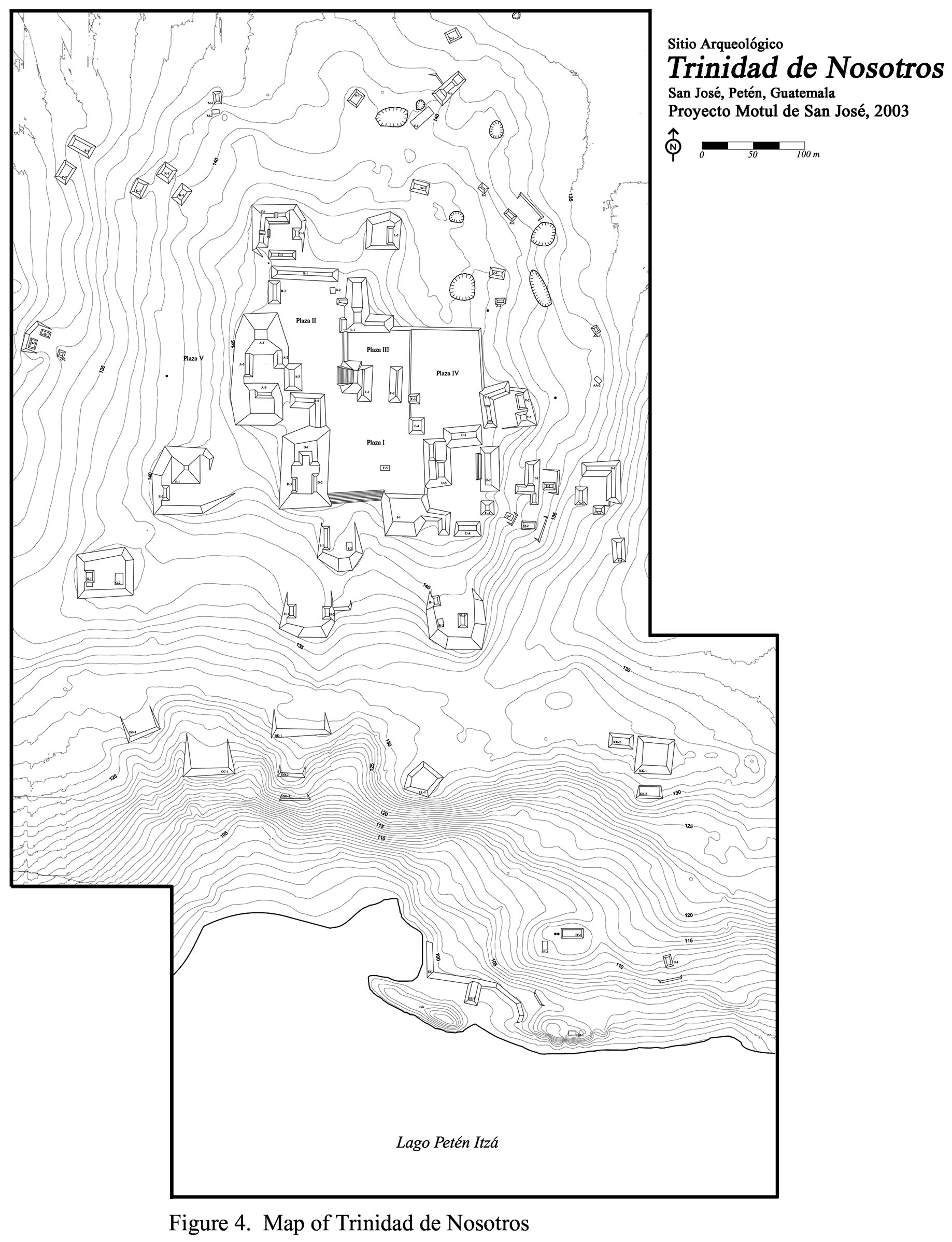
Figure 4. Map of Trinidad de Nosotros.
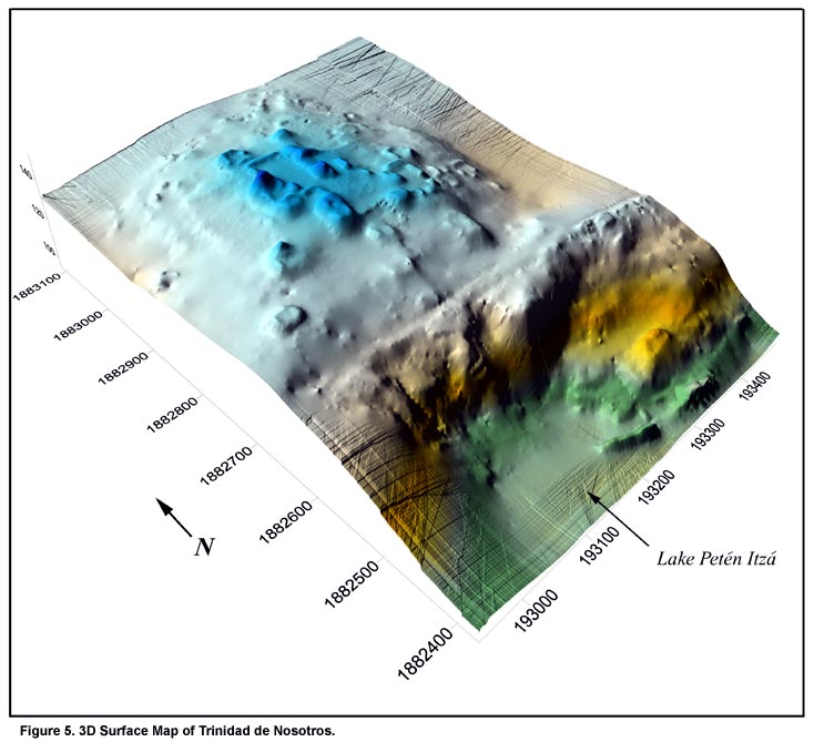
Figure 5. 3D Surface Map of Trinidad de Nosotros.
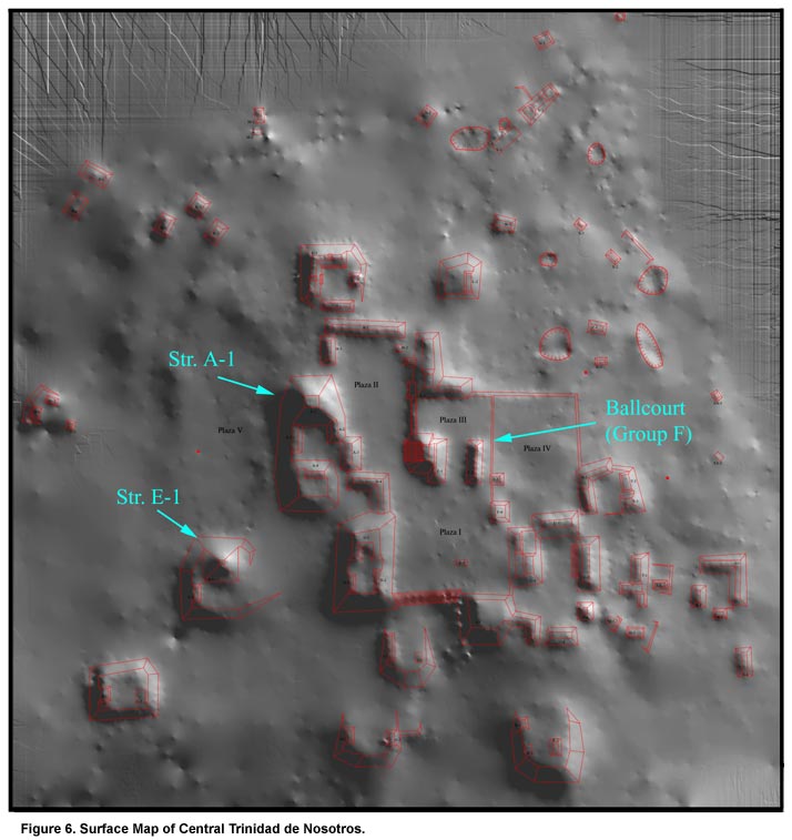
Figure 6. Surface Map of Central Trinidad de Nosotros.
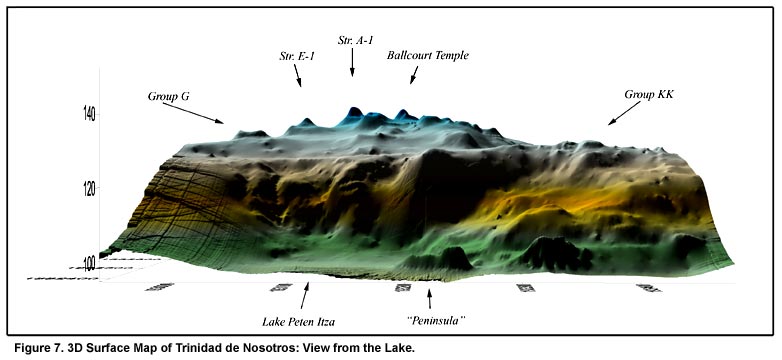
Figure 7. 3D Surface Map of Trinidad de Nosotros: View from the Lake.
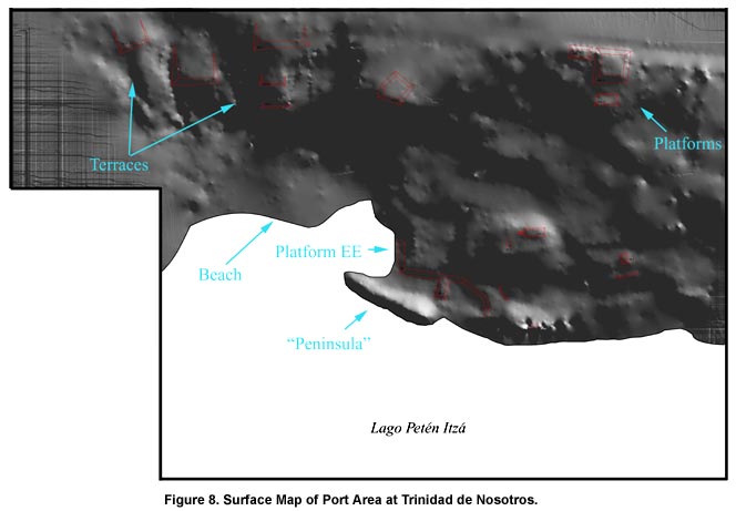
Figure 8. Surface Map of Port Area at Trinidad de Nosotros.
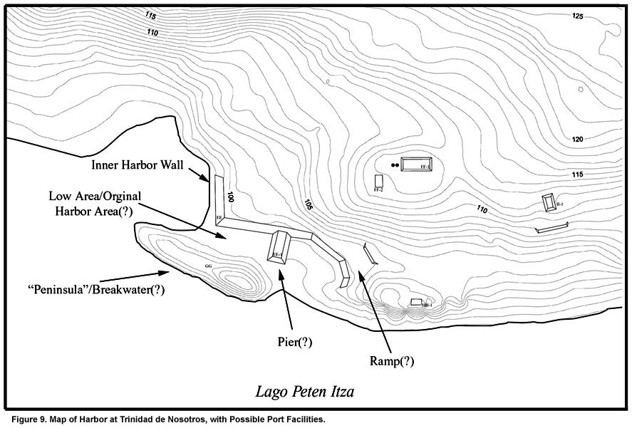
Figure 9. Map of Harbor at Trinidad de Nosotros, with Possible Port Facilities.
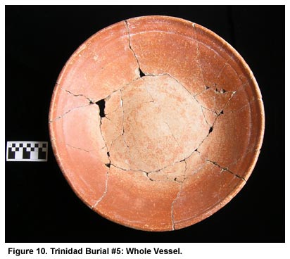
Figure 10. Trinidad Burial #5: Whole Vessel.
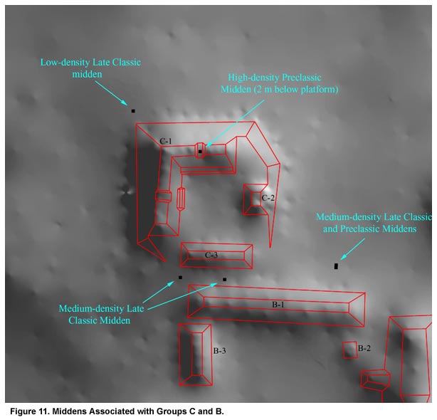
Figure 11. Middens Associated with Groups C and B.
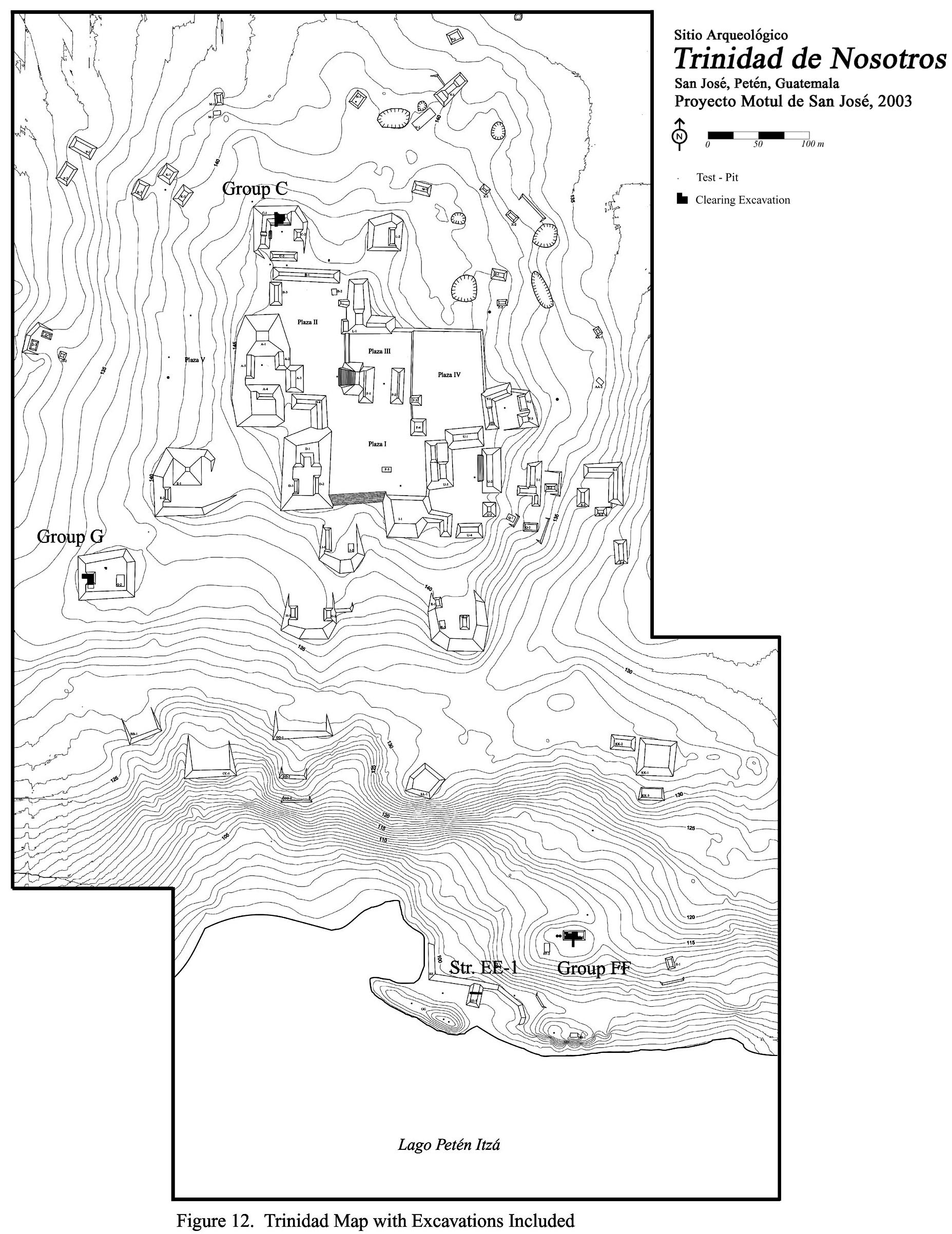
Figure 12. Map of Trinidad with Excavations Noted.
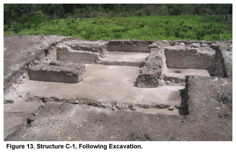
Figure 13. Structure C-1, Following Excavation.
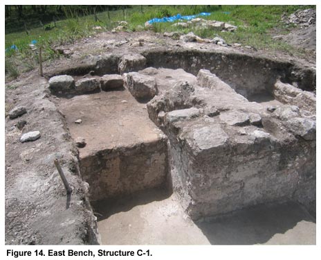
Figure 14. East Bench, Structure C-1.
Figure 15. Structure G-1, Following Excavation.
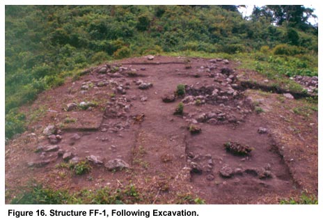
Figure 16. Structure FF-1, Following Excavation.
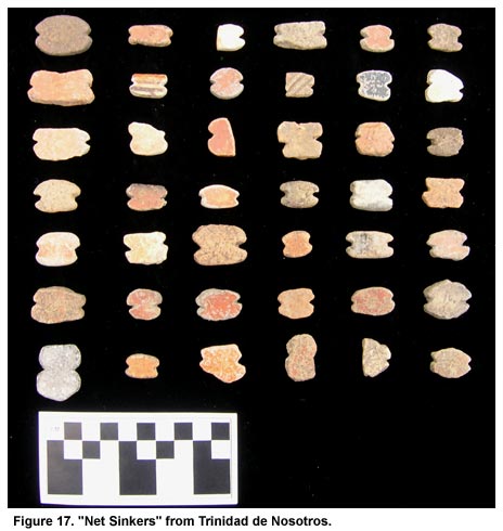
Figure 17. "Net Sinkers" from Trinidad de Nosotros.
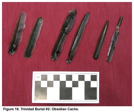
Figure 18. Trinidad Burial #2: Obsidian Cache.
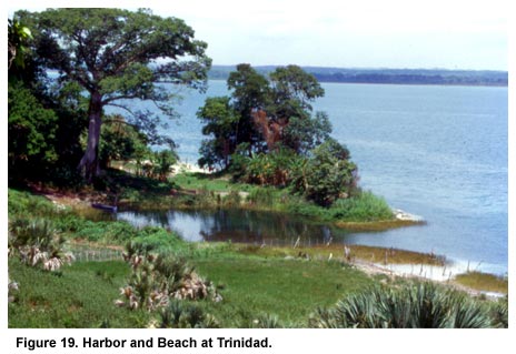
Figure 19. Harbor and Beach at Trinidad.
Previous Page | Table of Contents | Next Page
Return to top of page |