| FAMSI © 2005: Ann Cyphers |
||
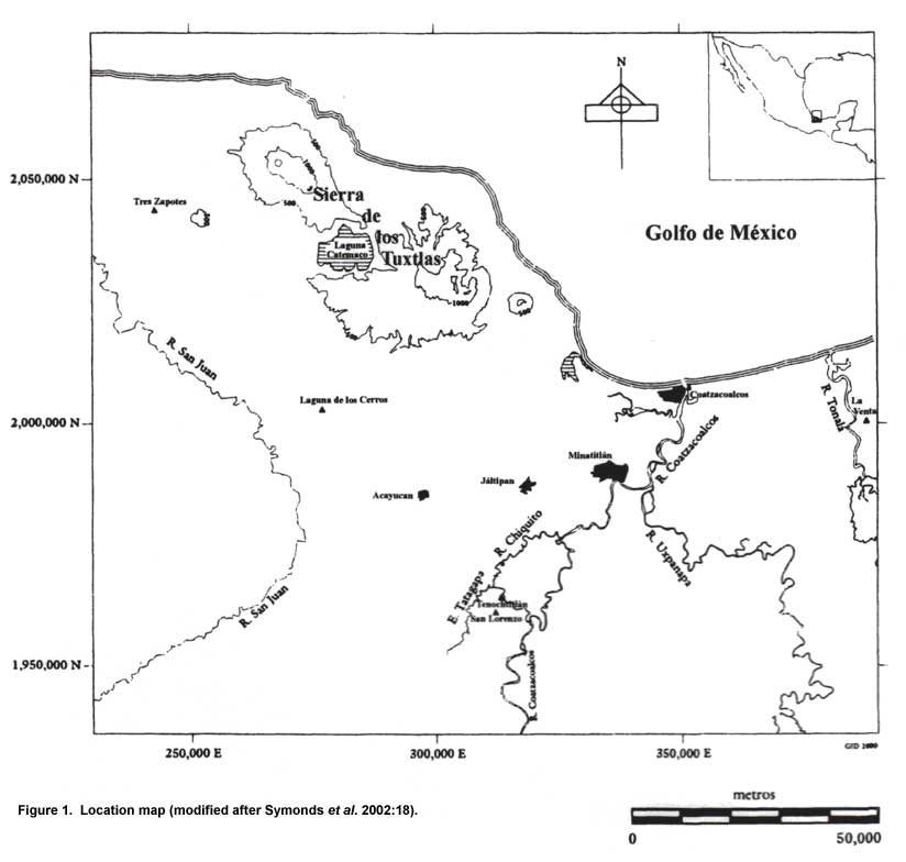
Laguna de los Cerros: Introduction Laguna de los Cerros is located in the low slopes of the Sierra de los Tuxtlas region, in the San Juan river basin, which is a part of the Papaloapan system (Figure 1). From its intermediary position between the extended San Juan river plains to the south, and those of the Hueyapan, Amayo and Cuitlazoyo rivers to the northwest, it dominates an area known to be one of the most favored transportation routes in historic times. Besides, it is located at the start of a natural pass which leads to the sierras’ hinterlands.
The architectural pattern of the site is composed of rectangular plazas flanked by long parallel mounds that terminate in conical mounds at each of its edges (Figures 2 and 3). Large residential platforms are associated with, or annexed to, the long mounds. Along the south coast, sites of the Classic period feature variations of this architectural style. The architectural dimensions in Laguna de los Cerros is expressing the colossal flourishment of this pattern.
The site, since Olmec times, has been an important place due both to its geographic situation and its vicinity to the basaltic flow that was quarried to carve the stone monuments (Medellín 1960; Gillespie 1994, 2000). Recent investigations do not support the notion that this site was a large Olmec center (Cyphers 1997; Borstein 2001; Cyphers and Borstein n.d.). |
||
| Return to top of page | ||
|
Text links to all pages at this site are available at the FAMSI INDEX |
||
. The site's name, Laguna de los Cerros, derives from the presence of this lagoon and the large prehispanic buildings locally known as \"cerros\" (hills).")
