| |
Laguna de los Cerros:
A Terminal Classic Period Capital in the Southern Mexican Gulf Coast
List of Figures
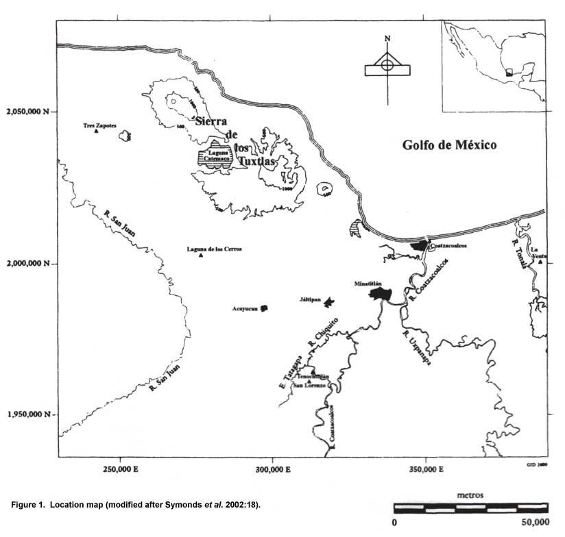
Figure 1. Location map (modified after Symonds et al. 2002:18).
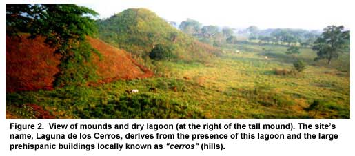
Figure 2. View of mounds and dry lagoon (at the right of the tall mound). The site’s name, Laguna de los Cerros, derives from the presence of this lagoon and the large prehispanic buildings locally known as "cerros" (hills).
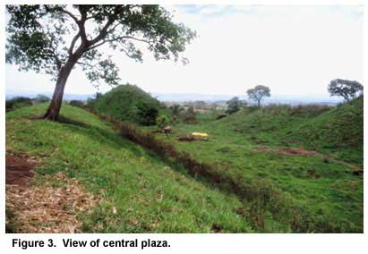
Figure 3. View of central plaza.
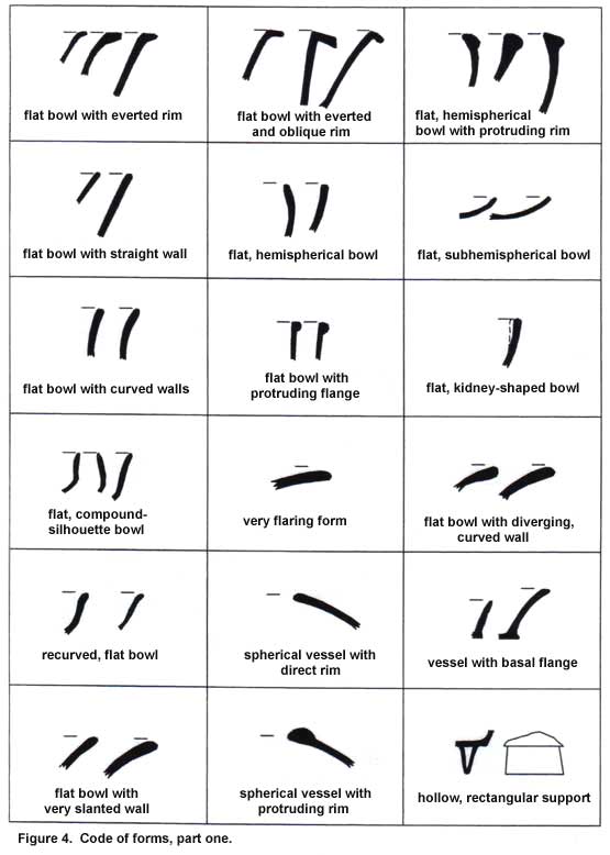
Figure 4. Code of forms, part one.
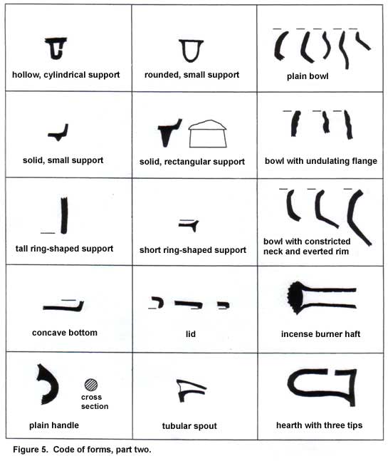
Figure 5. Code of forms, part two.
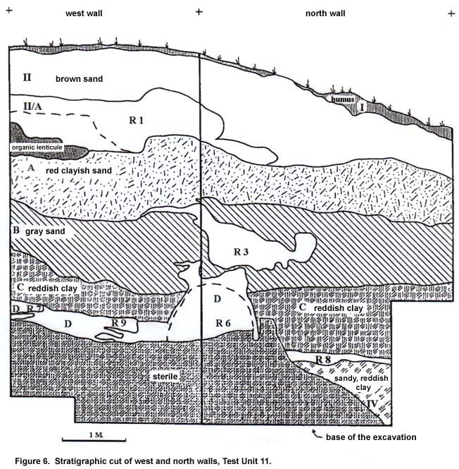
Figure 6. Stratigraphic cut of west and north walls, Test Unit 11.
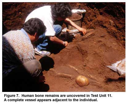
Figure 7. Human bone remains are uncovered in Test Unit 11. A complete vessel appears adjacent to the individual.
Figure 8. Human bone remains, Test Unit 11.
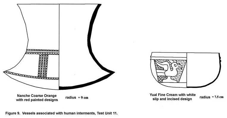
Figure 9. Vessels associated with human interments, Test Unit 11.
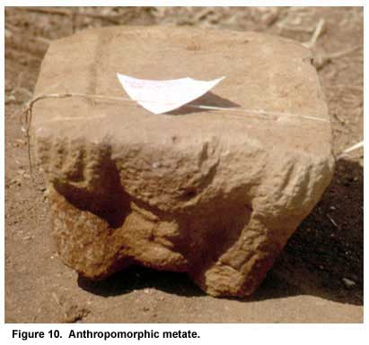
Figure 10. Anthropomorphic metate.
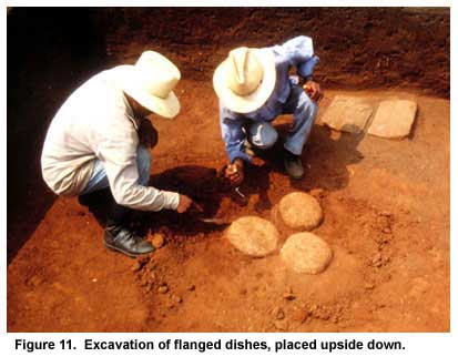
Figure 11. Excavation of flanged dishes, placed upside down.
Previous Page | Table of Contents | Next Page |