| FAMSI © 2008: Molly Morgan |
||
A Subsurface Testing Program at Chiquiuitan, Guatemala
Research Year: 2007 Table of Contents
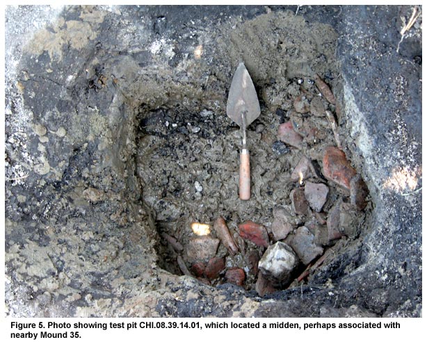
Abstract At Chiquiuitan, an Early and Middle Formative site on the Pacific coast of Santa Rosa, Guatemala, results from a subsurface testing program present a fine-grained picture of the use of space by the inhabitants of this ancient village. Excavated every twenty-five meters along randomly-selected north-south running transects across an area of approximately two square kilometers, data gathered from these 393 shovel pits have affirmed the assumption that the low area between the mounds was uninhabited, and have revealed evidence of activity in a part of the site previously thought to be culturally sterile. This research suggests that subsurface testing is an important means for gaining diachronic settlement information in areas such as the Pacific coast of Guatemala, where Formative structures are often unobtrusive and aggrading deposits can quickly conceal evidence of occupation and activity. This specific research method has provided a way to better understand the spatial component of past life at Chiquiuitan, reassess the extent and density of settlement at the village level, and investigate community variation. Chiquiuitan es un sitio del periodo Formativo Temprano y Medio localizado en la costa Pacifica del departamento de Santa Rosa, Guatemala en donde se realizó un programa de registros que tuvo como objetivo principal establecer si en el área fuera de los grupos residenciales existieron espacios ocupados por residencias o tal vez otro tipo de actividades. Se utilizó la metodología de excavación de registros manejando únicamente una pala, en los que se logro un pozo cada veinticinco metros en líneas de marca de eje norte-sur escogidos al azar. Los datos recolectados en el programa indican que el área entre los montículos fue utilizada solamente en pocas actividades. También se sugiere ocupación en un lugar que ya no se conocía. Estas investigaciones muestran el beneficio de registros pequeños para examinar ocupación en regiones como la costa Pacifica, en donde materiales culturales frecuentemente son enterrados debajo de estratos de sedimentación. Esta metodología provee un modo para aumentar el conocimiento de asentamiento en comunidades del Formativo. Click to download the report in PDF format: A Subsurface Testing Program at Chiquiuitan, Guatemala (904 KB) The PDF files require Adobe Acrobat Reader.
Submitted 10/01/2007 by: |
||
|
Text links to all pages at this site are available at the FAMSI INDEX |
||